Military Topographer's Day: what kind of holiday is it and how the topographic service helped during the war. Military Topographer Day in Russia Military topographers during the Great Patriotic War
It is impossible to name the exact starting point of the history of the Russian topographical service. Mapping and any research in the field of topography has always been a matter of national importance. Before Peter I, there was no clear division of cartography into military and civil.
During his reign, a quartermaster unit appeared in the army, whose task was to provide the troops with new maps. The emergence of the Navigation School made it possible to train our own specialists in the field of topography and geodesy. In the mid-eighteenth century, forty topographical service officers joined the General Staff. This period is considered to be the time when military topographers began working.
Officially military topographical service begins to operate in 1812. On February 8 of this year, the Emperor signed a corresponding decree. The Depot was led by a director who was personally appointed by the Emperor.
The work of the military topography service has always had great value. The lives of fighters and the outcome of battles and wars depended on the correct and timely map of the battle and on the study of enemy maps. Since 1940, the service has been part of the General Staff in the form of the Military Topographical Directorate. Before the collapse of the Union, the service included about one hundred and forty people.
The range of tasks assigned to military topographers currently looks like this:
Working with topographic maps: creating new ones, updating existing ones, accumulating reserves. Carrying out similar work in geodesy. Bringing maps and catalogs to military headquarters;
creation and accumulation of digital maps of the area, directing such resources to automatic systems for command and control of troops and weapons;
preparation of gravimetric and geodetic bases for ICBM launches, long-range aviation flights, artillery operations and combat duty of radio engineering complexes;
creation of satellite maps of the area, photographic surveys;
release of combat graphic documents;
carrying out state tasks in the field of cartography and geodesy.
The work of military specialists has no statute of limitations. Satellite maps and photographs of the terrain in Syria, taken during the Soviet era, help our air forces currently fight terrorists.
Russian specialists are actively working on creating geospatial models, using space units and ground support groups. In addition to the head center of space geodesy, navigation and cartography, the topographic service has created a geospatial information center, an expeditionary detachment, and military units of various subordination.
In their work, military specialists use modern technical means. Among them:
ARM-EK – automated complex of workstations;
"Volynets" - self-propelled topographic system;
"Violit" - hardware and software complex;
PNGK-1 – astronomical and geodetic complex;
"Geonika-T" is a navigation and geodetic system.
The latest technologies make it possible to deploy the necessary equipment in a minimum amount of time and begin performing combat missions.
No technical means can replace the experience and knowledge of a specialist. I would like to wish the representatives of this most difficult profession to be at their best, to avoid losses, and to always be needed by the Motherland.
The success of combat missions depends on many factors. One of the most important is terrain orientation. Many methods have been developed for this, including the use of cards. They must accurately reflect the area: its features, landmarks, names of objects. A professional holiday is dedicated to specialists engaged in such activities.
Contents of the article
When is it celebrated?
Military Topographer Day is celebrated annually on February 8th. It is not a national holiday. At the official level, it is enshrined by Order of the Minister of Defense No. 395 of November 9, 2003 “On setting the date for the holiday of the Military Topographical Directorate of the General Staff of the Armed Forces Russian Federation" The document was signed by I. Sergeev.
Who's celebrating
Everyone involved in this area of activity, regardless of rank and position, takes part in the celebrations. Among them are the personnel of the Topographical Service Armed Forces Russian Federation, surveyors, cartographers. Their relatives, friends, acquaintances and close people join the events. Teachers, cadets, and graduates of specialized educational institutions consider the holiday to be theirs.
History and traditions of the holiday
Military Topographer Day in Russia dates back to 2004, when the first official celebrations took place. They were preceded by a corresponding order from the Minister of Defense. The purpose of the action, enshrined in the official’s document, is to increase the prestige of the profession and appreciation for the work of specialists.
The date chosen has a symbolic meaning. It is timed to coincide with publication in Russian Empire February 8, 1812 Regulations that prescribed the formation of a structure - the prototype of a modern department, thanks to which the army owes many successes.
The 2020 celebrations are celebrated primarily in educational and professional settings. The officers gather at the festive tables. They share their accumulated experience, discuss news, tell stories from life and everyday work. Colleagues take pictures as souvenirs, show photos from albums, and watch videos.
Congratulations are heard, warm words of toast are complemented by the clink of glasses. Valuable gifts are given. The command makes speeches, presents certificates of honor and medals for outstanding achievements. It is customary for employees to be promoted in positions and ranks. The so-called ritual of washing the stars is carried out. The insignia is immersed in an alcoholic beverage that must be consumed. Thank you notes are included in personal files.
Military Topographer Day 2020 is marked by the publication of materials through mass media, which are devoted to the profession and related topics. The main characters of the interview are soldiers and officers. Cadets make presentations and join events.
About the profession
Specialists are engaged in creating maps and coordinate reference systems. They conduct topographic and geodetic alignment of artillery and other units. The tasks include determining the spatial characteristics of various artificial and natural objects and recording them. They are involved in the construction of engineering structures.
The profession requires knowledge in such exact sciences as mathematics, physics, geology. Career begins during military service in the Armed Forces or after graduation from higher education educational institution at the Ministry of Defense. It includes not only theory, but also practical skills in using aerial photography and space photography materials, control and measuring instruments.
The knowledge and skills of topographers are in demand in civilian life.

Every year in Russia it is celebrated Military Topographer Day. Officially, this professional holiday has been celebrated since 2004, since in 2003, by order of the Minister of Defense No. 395, the date of the holiday was set - February 8, which was not chosen by chance.
It was on February 8 () 1812 that the Regulations for military topographical affairs were approved. The structure created by the royal decree changed its status several times. Today it is the Military Topographical Directorate of the General Staff of the Armed Forces of the Russian Federation.
The history of topographic surveys itself has an even longer history. The journeys of explorers and sailors would be meaningless without the creation of cartographic materials. The first Russian atlas, “Drawing Map of Siberia,” was compiled by geographer Remezov in 1701 and presented it to Emperor Peter I. Ten years later, in 1711, a quartermaster unit was formed in the Russian army, whose responsibilities included supplying troops with maps. Also, under Peter I, the School of Mathematical and Navigational Sciences was organized in Moscow, where astronomers, surveyors and topographers were trained.
The military topographical service in the Russian army began with 40 officers - column leaders, surveyors and topographers. They entered the General Staff, which appeared in 1763. In 1797, the Map Depot was established, which was supposed to organize all cartographic materials created by that time. In 1812, the depot was renamed military topographical.
Interestingly, the world's first specialized military school topographers appeared in Russia. It opened in 1822 under the Corps of Military Topographers.
The topographical service has always been especially secret - after all, any battle began with a map, and getting maps of the enemy was a major task for warriors at all times. Sometimes the information obtained was decisive in the battle.
Thus, in 1943, Soviet intelligence learned that hundreds of thousands of sheets of maps of the Oryol, Belgorod and Kursk regions were being printed in Germany. This information formed the basis for the massive defense plan and subsequent offensive of the Soviet army on Kursk Bulge. As for Soviet topographers, surveyors and cartographers, during the Great Patriotic War more than 4 thousand of them were awarded high awards.
Nowadays, the work of a topographer remains honorable, although the specifics of the work of these specialists are constantly changing - with the development of modern technology. Satellites, laser and quartz devices come to the aid of topographers. However, no technology can replace human experience and knowledge. Today, military topographers accept words of gratitude for their responsible work.
The range of military professions is unimaginably wide. Armored vehicle driver, radio operator, flight engineer, sapper, reconnaissance officer - each of these specialties is important in its own way, regardless of whether it is directly related to actions on the battlefield or not. February 8 is another professional holiday of people performing their military duty to the state and its people. The essence of their specialty is not to go to the enemy with weapons in hand, troubleshoot combat vehicles, or drive vehicles to the intended target. The element of these people is maps of the area, which require competent compilation and indication of all the necessary objects on them. Military topographer is the profession that will be discussed in this article and their professional holiday “Military Topographer Day”, which is celebrated annually on February 8th.
History of the holiday February 8
The holiday on February 8, “Military Topographer’s Day,” is a professional day for people whose competence includes the practical application of knowledge in the field of geodesy and cartography, which dates back to 1812, when an important document was signed in Russia - the Regulations on Military Topographical Affairs. At the same time, the specified date is not the moment of the creation of the Military Topographical Service: its history started much earlier, and the prerequisites for the emergence of this structure relate to XVIII century. Back in 1701, Peter the Great, who ruled the Russian Empire, received as a gift from the geographer Remezov the first atlas that “illustrated” the Siberian expanses.
This event gave impetus to the emergence of a specific unit called the “quartermaster unit” - only this happened 10 years later. The independent specialty of military topographer did not yet exist, but officers of the newly created structure had to be able to draw maps, among their other duties. Later, at the behest of the same Peter the Great, an educational institution that trained topographers and surveyors appeared in today’s Russian capital.
The year 1763 was marked by the creation of the General Staff, which included the best military specialists in the field of the above-mentioned sciences. 34 years later, a structure was established that is the direct ancestor of the modern Topographical Service of the Armed Forces of the Russian Federation - Map Depot. After that, it changed its name several times, but the essence remained the same: representatives of this structure created and updated topographic maps over time, supplied them to military units and solved other important tasks.
First specialized educational institution for the training of military topographers arose in 1822 in the northern capital.
Currently, this is not the only educational institution of this kind, but it is the most prestigious, including in terms of the quality of knowledge received by officers.
Profession of military topographer

The maps that are the subject of the work of military and ordinary topographers are not just multi-colored pictures with symbols that are meaningless to most ordinary people. This is the result of painstaking work that requires a specialist to invest effort, time and health. In essence, a topographic map is a vivid illustration of the area in relation to which a detailed plan is drawn up.
Everything necessary to carry out this labor-intensive process is obtained from surveys taken not only on the ground, but also from a flying vehicle, and even from space, as well as measurements.
What is a map directly for a military topographer? The very name of the profession of a military topographer gives us the answer to this question: a reliable means of deploying, determining the coordinates of troops, and exercising command over them. Modern technologies simplified all these tasks as much as possible, but the use by topographers in their work of such qualities as speed of reaction, attentiveness, and perseverance has not been canceled. And for one reason or another, there may simply not be an opportunity to use a digital card. That’s when a paper topographic version and the skill of a qualified specialist will come to the rescue. But in the process of drawing up colorful plans of the area, new items technical progress irreplaceable: today's devices have the highest accuracy and maximum convenience.
The profession of a military topographer, as they say, is “both dangerous and difficult.” These specialists are called “the eyes of the army” because their work is not limited to paper transactions, but includes field trips, wartime- into enemy territory.
It is not difficult to guess how such “travels” may end... But there is also a big advantage for specialists in this field - this is the almost indefinite relevance of the profession. This means that military topographers will always be in demand.
“No one is forgotten, nothing is forgotten...”
There were a great many heroes among officers in the past - the source of exploits does not dry up even now. It is impossible not to admit that for modern military men the names of sons loyal to the Motherland who have sunk into oblivion serve as an example first and foremost. In such a field as topography, there are also many distinguished masters of their craft who have made an invaluable contribution to the development of science as a whole and to the process of stimulating today's specialists.
Few ordinary residents of the Russian Federation know that the opening of the high point in the Tien Shan mountains - the merit of representatives of a useful topographical direction. This event led to the awarding of a state prize to the resourceful group. Why was it necessary to take such a crucial step?
The mountainous area is a difficult-to-reach area, but no one knows what its fate will be: maybe this area will become the target of an expedition or a field of military retreat in the future?..
60s of the last century turned out to be extremely fruitful in relation to the ice continent - Antarctica. Topographers found out that the “queen of icebergs” is the mainland, plus they compiled a map of the local relief, hidden from view by a snow-white crust.
Each region of our vast country has a strong connection with one or another famous specialist who dedicated the goals of his work to the Fatherland. Thus, in the Asian part of the state they remember N. Przhevalsky, in the Arctic - S. Chelyuskin, in Primorye - V. Arsenyev. And topographer A. Pastukhov became famous for being the first among the Russian military to conquer Elbrus.
But the creators distinguished themselves most of all geographical maps, of course, in the context of armed clashes during the Great Patriotic War. According to historians, in just six months, topographers drew up a plan of the area on a mind-bogglingly large scale - 1:100,000.
And this in the most difficult atmosphere, when bullets are whistling overhead, and the possible victory of the state depends on the relief image!..

No matter how complex the profession of a military topographer may be, no matter how responsible the main task of a qualified specialist is, he cannot be lacking in fascination. But it is known that the work turns out to be of especially high quality if you have an interest in performing your official duties.
Be sure to congratulate the specialists on the holiday of February 8 - Military Topographer's Day, and wish them successful everyday life, more enthusiasm and unearthly career heights!
Dear readers, please don't forget to subscribe to our channel at
At the origins of military topography
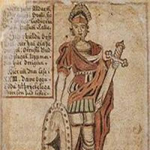
The rapid development of topography began under Peter I, who paid great attention to improving military engineering, geodesy, and cartography. In 1711, as part of Russian army A quartermaster unit appeared, which was entrusted, among other things, with the task of providing the Russian army with cartographic materials. In the quartermaster units, positions of individual officers were introduced who were responsible for drawing up maps and collecting information about the area. These were the first Russian military topographers. The School of Mathematical and Navigational Sciences appeared in Moscow, where future surveyors and topographers were trained. When the General Staff was created in 1763, it included 40 staff officers and chief officers - surveyors and topographers, who laid the foundation for the military topographic service created later. In 1797, His Imperial Majesty's own Map Depot was created, which was engaged in the compilation, printing and storage of topographic maps and atlases. The director of the Card Depot was subordinate to the Quartermaster General of the Russian Army. Major General Count Karl Ivanovich Oppermann (1766-1831), a professional military engineer who came from a noble family of the Duchy of Hesse-Darmstadt, was appointed to the post of director of the Card Depot. Having received engineering education, Karl Oppermann began his military service in the Hessian army, and then asked for Russian citizenship. Empress Catherine II answered in the affirmative and, as it turned out, not in vain. Karl Opperman made a great contribution to the development of the domestic military topographical service, engineering troops and, in general, to strengthening the defense capability of the Russian Empire. Under Opperman's command, 22 officers seconded from the Engineering Department, the Quartermaster Unit and army units served at the Map Depot. In 1801-1804, it was the Map Depot that prepared and published the Stolistic map of the Russian Empire. On February 8, 1812, the Map Depot was renamed the Military Topographic Depot, after which it was reassigned directly to the Minister of War. For the period from 1812 to 1863. The military topographic depot became the main body of the Russian army, responsible for the supply of cartographic material.
Corps of Topographers
In 1822, under the leadership of the Military Topographical Depot, the Corps of Topographers was created. His responsibilities included direct topographical and topographical geodetic support for the Russian army, bringing topographical material to headquarters and troops. The Corps of Topographers included officers - surveyors, class topographers, class military artists, non-class artists, students of topographers and artists, non-commissioned rank topographers. Servants of the Corps of Topographers were engaged in conducting topographic surveys, creating maps and plans, and surveying terrain - not only in the interests of the military department, but also the Geological Committee, the Ministry of Agriculture, the Ministry of State Property, and the Committee for the Construction of State Roads. In 1832, the Corps of Topographers included 70 officers and 456 surveyors. 8 companies were created. The first company, numbering 120 people, was called the company of the Military Topographical Depot. The remaining seven companies operated throughout the Russian Empire. The leadership of the Corps of Topographers was carried out by the Quartermaster General of the General Staff through the Military Topographic Bureau.
At the origins of the organization of the Corps of Topographers was Major General Fyodor Fedorovich Schubert (1789-1865). In 1803, at the age of fourteen, Schubert began serving as a column leader in the retinue of His Imperial Majesty in the quartermaster unit, then participated in a number of military campaigns in early XIX V. During the Patriotic War of 1812, Captain Schubert, as quartermaster of the 2nd Cavalry Corps, not only carried out his direct duties, but also showed courage and bravery directly during the battles.  Adjutant General Baron Fyodor Karlovich Korf noted in his report that Schubert personally helped him keep the cavalry regiments from retreating under enemy fire. Schubert's courage contributed to his rapid advancement in ranks - he was soon awarded the rank of lieutenant colonel and then colonel. He served as chief quartermaster in the infantry and grenadier corps. In 1819, Colonel Schubert was transferred to the General Staff - to the position of chief of the 3rd department of the Military Topographical Depot, and the following year became the head of triangulation and topographic survey of the St. Petersburg province. At the same time, in 1820, 31-year-old Colonel Schubert was promoted to major general. Since it was Schubert who developed the project for creating the Corps of Topographers, he was appointed to the post of director of the Corps in 1822. Three years later he became a manager, and in 1832 - director of the Military Topographical Depot. At the same time, General Schubert also served as Quartermaster General of the General Staff of the Russian Army. In 1866, the Corps of Topographers was transformed into the Corps of Military Topographers, which was headed by the head of the Military Topographic Department of the General Staff. It is noteworthy that the Russian armed forces still maintain the practice of combining the positions of head of the topographic service and head of the Military Topographic Directorate of the General Staff. By 1866, the strength of the Corps of Military Topographers was 643 people. 6 generals, 33 staff officers, 156 chief officers, 170 class topographers, 236 non-commissioned officer topographers, 42 topographer students served there. It should be noted that in 1866, the Military Topographical Department was created as part of the General Staff, which replaced the Military Topographical Depot as the central governing body of the military topographical service. As for the Military Topographical Depot, it was liquidated. Military topographic departments were also created at the headquarters of the military districts - Orenburg, West Siberian, East Siberian and Turkestan. For the remaining military districts it was planned to have 2-4 seconded officers and class topographers from the Corps of Military Topographers. In 1877, in accordance with the new regulations on the Corps of Military Topographers, the number of personnel in this service was reduced to 515 people. At the same time, 6 general positions, 26 staff officer positions, 367 chief officers and class topographers also remained in the Corps. It should be noted that class topographers were civil officials who were part of the staff of the Corps of Military Topographers and who had the corresponding civilian ranks according to the Table of Ranks of the Russian Empire. In addition, in 1890, the Regulations on the field control of troops in peacetime, which provided for a staff of topographic officers in various connections. Thus, 5 staff officers of the Corps of Military Topographers were seconded to the army headquarters, and 2 chief officers and 1 junior topographer were sent to the headquarters corps. In 1913, the holiday of military topographers was established - February 10 (in honor of St. Ephraim the Syrian). As we improve technical means, which are in service with the Russian army, there was also a modernization of methods for conducting topographical activities. Thus, after the spread of the telegraph network in the Russian Empire, a method for determining geographical longitudes, based on the time of telegraph transmission between designated points, developed by Colonel Forsch, began to be used. In 1915, in connection with the advent of aviation, officers of the Corps of Military Topographers began to actively use the method of aerial photography. At the beginning of 1917, photometric (later photogrammetric) units were created.
How military topographers were taught in the Russian Empire
 We should also talk about the training of topographical officers in the Russian Empire. Topographical service, in contrast to service in guards and cavalry units, in navy, never enjoyed special prestige and was associated with the need for long and painstaking study and complex, routine work. Therefore, among the topographical officers there were few people from noble families. For a long time, future topographers learned their craft and only after 8-12 years of work and passing exams did they receive an officer rank. The first educational institution where specialists in topography and geodesy were trained was the School of Mathematical and Navigational Sciences, opened by Peter I. In 1822, after the creation of the Corps of Topographers, the School of Topographers was opened in St. Petersburg. The “Addition to the Regulations on the Corps of Topographers” listed the basic principles for organizing the training of officers - topographers and announced the creation of the School of Topographers. On October 22, 1822, the school was opened as a two-year school with a four-year term of study. Since that time, October 22 has been considered the traditional annual holiday of the educational institution that trains military topographers of the Russian army. The first graduation from the School of Topographers was held in 1825. Only 12 officers were released and received the rank of warrant officer. In 1827, the second graduation of officers took place, after which every year the Russian army began to be replenished with new officers - topographers. The small staff of the Corps of Military Topographers also determined the small number of graduates of the School of Topographers. But, as they say, the school’s graduates were taken “not by quantity, but by quality.”
In 1832, the School of Topographers was renamed the School of Topographers, which was due to the lack of the benefits that were assigned to specialized schools. When all the topographers of the Topographer Corps were consolidated into companies, the company stationed in St. Petersburg formed the School of Topographers, which included 120 topographers of the 1st and 2nd classes. In 1863, the School of Topographers was returned to its previous name - the School of Topographers, and at the same time graduates of the School of Topographers were given the right to enter the geodetic department of the Academy of the General Staff. On December 24, 1866 (January 5, 1867), the new name of the School of Topographers was approved - Military Topographical Junker School. The school has been expanded training programs. However, in 1883-1885. Enrollment at the school was not carried out due to the growth of the revolutionary movement in the country. After the resumption of enrollment in the school in September 1886, it was again deprived of the privileges of other cadet schools and existed in this status until 1892, when it was again granted the right for graduates to enter the geodetic department of the Academy of the General Staff. In 1906, an additional geodetic class was introduced into the school, the number of which was determined to be 10 people. In just 95 years of the school’s existence - from 1822 to 1917 - it trained more than 1.5 thousand specialists in the field of military topography and geodesy with the rank of officer. Topographical officers played a vital role in ensuring the defense capability of the Russian Empire and took part in all possible military campaigns. Moreover, the level vocational training and education allowed the leaders of the Corps of Military Topographers, if necessary, to take over the leadership of the General Staff. Among the officers of the military topographic service of the Russian Empire there were outstanding scientists who made a great contribution to the development of topography as a science. On November 15 (November 28 - new style), 1917, an order was issued to demobilize the Russian army. However, the Corps of Military Topographers continued to exist under a new name until 1923 - as a structure of the Military Topographical Directorate as part of the All-Russian Main Staff (Vseroglavshtab), created on May 8, 1918 and existed until February 10, 1921, when it was merged with Polevoy headquarters of the Red Army to the Headquarters of the Red Army.
From military topographical school to college
In 1923, the Corps of Military Topographers of the Red Army was renamed the Military Topographical Service of the Red Army. Thus began the history of a qualitatively new structure. A Military Topographical Department was created at the Headquarters of the Red Army, after the creation of the General Staff of the Red Army in 1935, which in turn became part of it as a department. IN Soviet Army The military topographic service was further developed and, in fact, formed in the form in which it exists today. Being part of the headquarters service, the military topographic service had its own bodies in the headquarters of formations, operational formations, and also had its own special units and institutions, which included topographic, geodetic, aerial phototopographic detachments, map warehouses, and cartographic factories. The main task The military topographic service was left with the compilation and preparation of topographic maps, the collection of geodetic data, the organization of topographic training of troops, and research work in the field of cartography, geodesy, and aerial photography.

After the start of reforms in the military sphere caused by October Revolution and the construction of the Red Army, the need arose to create a special educational institution for the training of military topographers. The fact is that, in accordance with the Order of the Council people's commissars According to naval affairs No. 11 of November 14, 1917, military educational institutions of the old Russian army were supposed to be disbanded. At the same time, the order of the Main Commissariat of all military educational institutions of the Russian Republic No. 113 of November 18 and No. 114 of November 28, 1917 specified that special technical and naval military educational institutions, the Military Topographical School and the Main Gymnastics fencing school is not subject to disbandment. This moment was very important, as it demonstrated the focus on preserving the experience that had been accumulated by these military educational institutions. However, on January 2, 1918, the Executive Committee of the Council of Khvalynsk, which was designated as the gathering place for the military topographical school cadets sent on leave, decided to dissolve the school. But this dissolution was only a formal moment in the history of this military educational institution. On July 18, 1918, in accordance with the order of the People's Commissar for Military Affairs, the First Soviet Military Topographical Courses were opened in the city of Volsk on the basis of the former Military Topographical School. However, since Khvalynsk was in the hands of the White Czechs, who decided to transfer the personnel of the military topographic school cadets to Novonikolaevsk and then to Omsk, it was decided to open Soviet military topographic courses not in Volsk, but in Petrograd. Former geodesy teacher G.G. was appointed head of the Petrograd courses. Strakhov, military commissar - E.V. Rozhkova. Already on December 16, 1918, classes began on the courses. This day is considered the founding day of the Soviet School of Military Topographers. 50 people were enrolled for training, another 11 people continued their studies in their senior year. By April 1, 1919, 131 cadets were studying at the courses. Soviet power managed to get hired a whole series prominent scientists and teachers, which ensured a normal educational process during the courses and the transfer of knowledge and experience to a new generation of cadets. In 1919, a three-year course of study was established, and on June 5, 1919, 10 cadets who completed their senior year were assigned as topographers to the Workers' and Peasants' Red Army. These were the first military topographers trained by the Soviet government.
Meanwhile, the school's cadet personnel, transferred to Novonikolaevsk, continued their classes. In the fall of 1919, there were even new cadets accepted. When Novonikolaevsk was liberated by units of the 5th Army of the Eastern Front of the Red Army, it was decided to continue the educational process of the cadets. F. Parfenov was appointed military commissar to lead political life. On February 7, 1920, the school was renamed the Siberian Military Topographical Courses. Soon they were transferred to liberated Omsk, where they were housed in the building of the Omsk cadet corps. In 1921, the Omsk Military Topographical School was opened on the basis of the courses. On November 1, 1921, 147 cadets were trained there. On November 9, 1922, the Omsk military topographic school began to be officially called the 2nd Omsk military topographic school, and at the beginning of 1923 it was relocated to Petrograd. In Petrograd, both military topographical schools were united, after which the only military educational topographical institution in the country, the Petrograd Military Topographical School, was revived. In 1924, at the First Congress of Military Topographers, it was decided to increase the level of training in the military topographic school. This decision was facilitated by the speech of the head and commissar of the Military Topographical Department of the Red Army Headquarters A.I. Artanov, who drew attention to the highly specialized nature of the training at the school. Therefore, in 1925, it was decided to improve the school’s curricula, increase the level of political work in the educational institution, and create Command Improvement Courses (CUKS). In addition, commanders from a variety of military branches were sent to the school and decided to receive a military topographical education. In 1928-1929 the school was given an aerial unit. Positive changes in the organization educational process schools could not help but be noted by senior management. In 1929, the head of the Military Topographical Department of the Red Army Headquarters, A.I. Artanov, praised the school for the good equipment of its classrooms, especially noting the darkroom, transformer and assembly rooms, military and terrain classes. Simultaneously with the improvement of the training base, the number of cadets also increased, since the Red Army needed an increasing number of military specialists - topographers, who were sent for further service in army formations. At the Improvement Courses for Commanding Officers, training began for photogrammetrists, advanced training for specialists - topographers, surveyors, cartographers, as well as retraining in topographical specialties for general-arms commanders, artillerymen, and military engineers. The school's cadets underwent internships in units of the Red Army as junior commanders. In 1937, the military topographic school was transformed into the Leningrad Military Topographic School. College graduates received military rank lieutenant. From the second half of the 1930s. Lieutenants graduated from the school took part in a number of military conflicts, primarily in the battles near Lake Khasan and on the Khalkhin Gol River. The first serious test was participation in the Soviet-Finnish war.
Military topographers during the war
 The path of teachers and graduates of the Leningrad Military Topographical School in the Great Patriotic War is full of exploits and covered with military glory. After the head of the LVTU, Lieutenant Colonel A. Gusev, left for the front, the school was headed by Colonel K. Kharin, who had previously headed the educational department. On June 30, 1941, the school cadets began preparing for the defense of the Strugo-Krasnensky camp, but were then returned to Leningrad. The sophomores who passed the control tests were promoted to lieutenants ahead of schedule in July 1941 and released to the front. Due to the war, the school switched to an accelerated one-year training period. The main task of the school during the war was the accelerated training of specialists for the artillery topographic service, carried out in the 4th special training detachment. In July 1942, Colonel K.N. Kharin, who headed the school, went to the front, and Lieutenant Colonel P.S. became the new head of the educational institution. Pasha, who, in turn, came from the ranks of the active army. At the time described, the school was stationed in Ababkovo, and only in January 1945 was a decision made to return to Leningrad. On April 5, 1945, the school was awarded the Red Banner and given the name “Leningrad Red Banner Military Topographical School.” During the Great Patriotic War, more than 3,000 graduates of the Leningrad Military Topographical School were awarded orders and medals.
The Great Patriotic War, practically in its first months, revealed the main shortcomings of the pre-war organization of the military topographic service in the Red Army. Firstly, it turned out that the troops were missing required quantity cards, some connections simply did not have them. The reason for this was the location of map warehouses on the western border Soviet Union. Retreating Soviet troops were forced to destroy map warehouses in the Baltic, Western, and Kiev military districts so that the most valuable secret information would not fall to the advancing enemy. In the territories occupied by Nazi Germany, there were a number of the most important objects of the military topographic service - a cartographic factory in Kyiv, an optical-mechanical workshop in Lvov, cartographic units in Riga and Minsk. Secondly, given that before the war the bulk of the military topographical units of the Red Army were stationed in the west of the Soviet Union, from the very first days of the war their personnel went to the front. The losses of the military topographical service in 1941 amounted to 148 officers, 1,127 sergeants and soldiers, and 15 civilian employees. Considering that military topographers are specialists of a narrow profile, the training of which requires not only special education, but also obtaining required experience, we can say that in the first months of the war these losses were irreparable. Therefore, it was necessary to transfer the military topographic school to the most accelerated terms of training, since the shortage of military topographers in this situation was felt especially acutely. In the most difficult conditions of the Great Patriotic War, the military topographic service had to solve a very wide range of tasks, which included: the creation and updating of topographic maps, the publication of topographic maps for active and rear units in huge editions, the delivery, storage and issuance of maps, photography of the area, including including directly during combat operations, monitoring the accuracy of the alignment of elements of artillery battle formations; marking landmarks on the ground; tactical interpretation of aerial photographs and determination of the coordinates of enemy targets; topographical reconnaissance of the area. The military topographic service did not forget about such an important task as organizing general topographic training of troops, which was also the responsibility of military topographers. At the same time, no matter how difficult it was for military topographers at the fronts, the tasks of further studying strategically important areas in other regions of the Soviet Union, including those far from the front line, on Far East and in Central Asia, in Siberia in the Urals.
The combat path of Soviet military topographers
The enormous experience gained by military topographers during the Great Patriotic War was used in the post-war years. It was the post-war period that became the era highest development and strengthening the Military Topographical Service of the Soviet Army. The general complication of military affairs in the second half of the twentieth century. required the Military Topographical Service of the SA to solve a number of new important tasks. These included: the creation of a global space geodetic network and the justification of a geocentric coordinate system for the use of missile weapons; creation of large-scale digital maps for precision weapon guidance systems; creation of means of monitoring spacecraft and new topographic and geodetic equipment; improvement of mobile means of topographic and geodetic support to solve urgent problems at the operational-tactical level; creation of electronic topographic maps for automated command and control systems, etc. Accordingly, solving these problems required a general increase in the qualifications of military topographers and improvement of their training. In the post-war period, the educational process at the Leningrad Military Topographical School also improved. So, with the advent and improvement of rocket- nuclear weapons, in the officer training program and in curriculum compulsory study of nuclear weapons and defense against nuclear weapons was introduced. In addition, military surveyors are beginning to gain more extensive knowledge in a number of disciplines that are extremely important for any officer. The school's cadets begin to study military engineering training, missile weapons and artillery, automotive engineering, and radio electronics. The school does not forget to give cadets knowledge in military pedagogy and psychology - after all, many of them will not only work in the field of topography, but also manage personnel. In 1963, the school received a new name - the Leningrad Military Topographical Red Banner School. The further development of the armed forces required the transition of most of the country's military educational institutions from secondary military schools to higher military schools. In 1968, the Leningrad Military Topographical School was renamed the Leningrad Higher Military Topographical Command Red Banner Order of the Red Star School. Accordingly, a four-year training period was established, and a transition to a system of departments was carried out. 11 departments were created at the school: phototopography, photogrammetry, geodesy and astronomy, higher geodesy, radio geodesy and radio electronics, cartography, tactical disciplines, higher mathematics, physics and chemistry, Marxism-Leninism, foreign languages, as well as the disciplines of the Russian language, automotive training, physical training. Like other higher military schools, a battalion for supporting the educational process appeared at the Leningrad Higher Military Topographical Command School. Since the school became higher, the staff category of “major general, lieutenant general” was established for its heads, and for deputy heads of the school - one step lower. Heads of departments, their deputies and senior teachers corresponded to the staff category “colonel”, teachers - “lieutenant colonel”. In 1980, the school was named after Army General A.I. Antonov.
A serious test for Soviet military topography in the 1980s was the war in Afghanistan. Fighting on the territory of another state, especially with such complex and varied terrain, represented a real test for the military topographic service. Boris Pavlov, who headed the topographic service of the 40th Combined Arms Army, recalled in an interview published in the Military-Industrial Courier in 2009, recalled that at the initial stage of hostilities in Afghanistan, the Soviet command did not have large-scale maps of the entire territory of this state (See: Umantsev, V. According to exact landmarks. Afghan dushmans were looking for any opportunity to obtain Soviet maps // Military-Industrial Courier, 2009, No. 8 (274)). The largest map was a map at a scale of 1:200,000. Accordingly, military topographers were faced with the task of creating such maps at a larger scale - first 1:100,000, and then 1:50,000. As the officer recalls, “maps at a scale of 1:100,000 The troops of the 40th Army were provided with 70-75 percent by 1985, and almost 100 percent by 1986. And they were fully provided with maps at a scale of 1:50,000 somewhere around 1986-1987.” In the same interview, Boris Pavlov assessed the topographical training of Soviet officers as weak, noting that his subordinates from the topographical service of the army had to conduct numerous topographical training classes for officers of all units, and even topographical lieutenants in this case acted as teachers in front of senior officers officers. In general, the topographic service in Afghanistan coped with its tasks with dignity even by the second half of the 1980s. was able to provide large-scale topographic maps to all units operating on the territory of this state.

Topographers remain the “eyes of the army”
In 1991, in connection with the reforms carried out in the country and the end of the existence of the Soviet Union, the Leningrad Higher Military Topographical Command Red Banner School of the Order of the Red Star was renamed the St. Petersburg Higher Military Topographical Command School. In 1993, a five-year training period was introduced at the school, and two faculties were created - topographic and geodetic. Then, during the era of renaming military schools into institutes, the school received a new name - the Military Topographical Institute named after A. I. Antonov (Military Institute (Topographic)). In 2006, the institute was included as a branch of the famous Military Space Academy them. Mozhaisky. Since 2011, the former military topographical institute has been part of the academy as the faculty of topographic support and cartography (the so-called “7th faculty”), with the departments of topographic support, cartography, higher geodesy, phototopography and photogrammetry, metrological support of weapons, military and special equipment. The faculty continues to train officers - specialists in the field of military topography and geodesy.
Meanwhile, it should be noted that the difficult 1990s were marked by numerous problems for military topographers. Reduced funding for the armed forces, low salaries, and the state’s inattention to the basic needs of military specialists—military topographers also had to go through all this. Many of them were forced, due to circumstances, to go into civilian life, and, it must be said, having a good practical education and extensive experience, as well as “bright minds,” they found a great job in civilian companies. After all, the need for highly qualified specialists in the field of topographic geodesy is also felt in the most important sectors of the Russian economy. At the same time, many “Soviet-trained” officers remained military service and made a huge contribution to the development of military topography in post-Soviet Russia.

In modern conditions, old paper maps have long been replaced by electronic ones, which are much more convenient to use. Military topographers are equipped with the latest mobile geodetic systems that record the smallest changes in the terrain while moving along the route. These complexes can transmit coordinates to troops over a distance of up to 50 km. At the same time, the army is not completely abandoning paper maps - after all, technology is technology, and in case of its failure or interruptions, the old, proven grandfather’s map can come to the rescue. An experimental Center for Geospatial Information and Navigation of the Southern Military District has been created in the Southern Military District. With the help of the latest developments in the field of digital and IT technologies, military topographers of the 21st century monitor the state of the radio navigation field of the GLONASS and GPS satellite navigation systems, provide military district automated control systems and high-precision weapon systems with geospatial information. Within 10 minutes, military personnel can deploy the latest equipment and begin performing combat missions. As noted on the website of the RF Ministry of Defense, the experimental Center is armed with the Violit and ARM-EK software and hardware systems, and the Volynets mobile digital topographic system. The technical equipment of the Center makes it possible to carry out the tasks assigned to military topographers both directly at the place of permanent deployment and in the field, moving to the area if necessary.
In connection with the demise of the USSR, in 1991 the Military Topographical Service of the Armed Forces of Russia was formed, which in 1992 was transformed into the Topographical Service of the Armed Forces of the Russian Federation. The head of the Topographical Service of the Armed Forces of the Russian Federation is at the same time the head of the Military Topographical Directorate of the General Staff of the Armed Forces of the Russian Federation. Currently, this position is held by Colonel Zaliznyuk Alexander Nikolaevich, previously from 2013 to 2015. holding the position of chief engineer of the Military Topographical Directorate of the General Staff of the Armed Forces of the Russian Federation. Russian military topographers continue to solve a number of complex problems in the interests of strengthening defense capabilities Russian state. It remains to wish the people of this complex and necessary military profession not to lose and constantly improve their skills, to do without losses, and most importantly - to always remain needed by their country.