Presentation for a lesson in geography (grade 7) on the topic: "Relief and minerals of Africa" \u200b\u200b- presentation. "Relief and minerals of Africa" \u200b\u200bpresentation for the lesson in geography (grade 7) on the Plains of Africa scheme presentation
1 slide
Completed by: Tudvaseva Valentina Alekseevna, teacher of the 1st category, MOU "School №14", Ivakinsky quarry, Alexandrovsk, Perm Territory.

2 slide
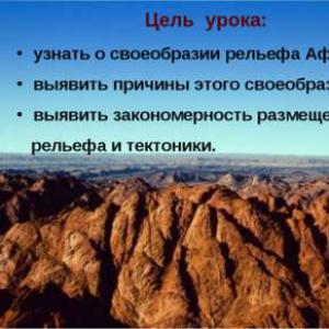
The purpose of the lesson: to learn about the originality of the relief of Africa; identify the reasons for this peculiarity; to reveal the pattern of placement of relief forms and tectonics.

3 slide
Lesson plan: Test (homework check) Review of previously completed material Practical work Features of the relief of Africa Minerals Crossword Homework Reflection

4 slide
Test yourself! 1. Establish a correspondence with the help of arrows: Date Researcher Discovery 1498 End of XIX century. Mid-19th century 1926 - 1927 Vavilov NI Livingston Vasco da Gama Juncker VV Zambezi River, Victoria Falls, description of the beginning of the Congo River, Lake Nyasa, etc. Information about Central and Eastern Africa. Collected 6000 samples of cultivated plants, proved that Ethiopia is the birthplace of wheat. Completed the opening of the sea route to India, rounded South Africa.

5 slide
2. Choose the correct answer: A. Africa - ... the largest continent. 1) the first 2) the second 3) the third 4) the fourth B. The southernmost point of Africa - ... 1) Cape Ben Sekka 2) Cape Agulhas 3) Cape Ras Khafun 4) Cape Almadi V. Africa is washed by the waters ... 1) Indian Ocean 2) Pacific and Atlantic oceans 3) Atlantic and Indian oceans 4) Pacific and Indian oceans D. The area of \u200b\u200bthe territory of Africa (together with the islands) is equal to ... million square meters. km. 1) 54.9 2) 30.3 3) 24.2 4) 17.8 11-12 points - "5" 9-10 points - "4" 6-8 points - "3" less than 6 points - "2 ".

6 slide
The relief is depicted on the map using layer-by-layer coloring, that is, with colors (green and brown) of different intensities. Participants with heights from 0 to 200 m are painted in green, and from 200 to 500 m in light brown, etc. Which color corresponds to a certain height or depth can be seen on the scale of heights and depths, which is available on any physical map. Relief image on the map

7 slide

8 slide
Purpose: to form a general idea of \u200b\u200bthe relief of Africa; to establish a connection between the structure of the earth's crust and relief. Equipment: physical map of Africa; map of the structure of the earth's crust. Work plan: 1. On the physical map of Africa, determine the main landforms of Africa, put them on a contour map. Fill in table 1 using a physical map of Africa. Using the data in the table, construct a diagram for comparing the mountains of Africa by height. 2. Analyze the map “Structure of the Earth's crust”. Determine at what time the African-Arabian platform was formed. 3. Establish a connection between the structure of the earth's crust and the relief of Africa. Fill in table 2. Practical work.

9 slide
Comparison of mountains by altitude Mountain names Highest point name altitude Atlas Toubkal 4165 m Akhagar Tahat Highlands 2918 m Tibesti Highlands Emi-kusi 3415 m Ethiopian Highlands Ras Dashen 4620 m Kilimanjaro East African Plateau 5895 m Dragon Mountains Katkin Peak 232657 m Darfur Marra Plateau 3088 m

10 slide
4165 m 2918 m 3415 m 4620 m 5895 m 3657 m 2326 m 3088 m Atlas Ahhagar Highlands Tibesti Highlands Ethiopian Highlands East African Highlands Drakensberg Mountains Cape Darfur Plateau

11 slide
The relationship between the main landforms and the structure of the earth's crust Main landforms The structure of the earth's crust Atlas Area of \u200b\u200bnew folding Sahara Desert Ancient platform Ethiopian Highlands Ancient platform, fault zone of the mainland Akhagar Highlands Ancient platform Tibesti Highlands Ancient platform East African plateau Ancient platform, area of \u200b\u200bancient folding, fault zone of the mainland Drakensberg Mountains Ancient platform Cape Mountains Region of ancient folding Kalahari Desert Ancient platform

12 slide
Low Africa predominantly has heights not exceeding 1000 m. The prevailing heights of High Africa are 1000-1500 m, and the highest mountains (Kilimandzho, Kenya, Rwenzori) exceed 5000 m. Despite the fact that the relief of a significant part of Africa is flat , according to the prevailing heights, the continent is divided into Low Africa (North, West, Central) and High Africa (East, South). Features of the relief of Africa

13 slide

14 slide
Scheme of the East African rifts The East African rift system is the longest fault zone on land, stretching for almost 6 thousand km. Volcanoes rise along it, and they are narrow deep depressions. This system consists of a series of horsts and grabens. Fault line

15 slide
Horst is a section of the earth's crust that occupies an elevated position and is bounded by faults. Graben is a subsided area of \u200b\u200bthe earth's crust, separated by faults.

16 slide
ATLAS (Atlas Mountains), in northwest Africa, within Morocco, Algeria and Tunisia. The length is about 2000 km. It consists of the ranges Tel Atlas, High Atlas, Middle Atlas, Sahara Atlas, inner plateaus and plains. Height up to 4165 m (Mount Toubkal). KILIMANJARO volcano is the highest point in Africa. In the African language, Kalimangara means “shining mountain”. It is a volcanic massif 5895 m high in East Africa, Tanzania.

17 slide
In the extreme south of the African continent, the CAPSKIE MOUNTAINS (up to 2326 m) rise, composed mainly of sandstones and quartzites. DRAGON MOUNTAINS are located in the southeast of Africa. Height up to 3482 m. Small mountains of Africa have a flat surface, like a table, and are called mesas.

1. Textbook: p. 344; § 17 Atlas: pp. 4-5, On p. 344, after the plan for describing the mainland GP, there is a plan for describing the plan for describing the relief of the territory 1. What is the general nature of the surface? How can it be explained? 2. How are the landforms located in the study area? 3. What are the highest and prevailing heights? 4. Find out what is the origin of landforms

Today we have to: - identify the main forms of relief in Africa; - to identify the time of the formation of the relief of Africa; - to identify the highest and lowest points of the continent; - to identify how landforms are associated with the tectonic structure of the continent; - find out what minerals Africa is rich in

Before starting to study a new topic, we need to remember: - What is a platform? - What is a folded area? - The main landforms? - What forms of relief are formed on the platforms? - What forms of relief are formed in folded areas? - Types of plains in height; - Types of mountains in height; - How to determine the age of a tectonic structure using the map "Structure of the Earth's crust"?


Forms of Africa's relief Forms of relief The structure of the earth's crust Chad Basin Congo Basin Kalahari Basin East African Plateau Atlas Cape Mountains Drakensberg Mountains Ethiopian Highlands Ancient platform Ancient platform, Baikal folded region, fault zone Cenozoic folded region, Hercynian platform ancient platform

Revealing the features of the relief of Africa

Features of the relief of Africa 1. The relief of a significant part of Africa is flat. 2.North, central and western parts of the mainland than the eastern and southern. below, 3. According to the prevailing heights, the continent is divided into Low Africa and High Africa 4. The highest point in Africa is located not in the mountains, but on the plain (plateau). 5. Within Africa, there is the largest fault on land, called the Great African Rift.

What are the numbers on the map: Atlas Mountains Cape Drakensberg Mountains Ethiopian Highlands East African Plateau Chad Basin Kalahari Basin Congo Basin


Preview:
To use the preview of presentations, create yourself a Google account (account) and log into it: https://accounts.google.com
Slide captions:
Relief of Africa Geography. Continents, oceans, peoples and countries. Grade 7 Presentation for lessons No. 22 The presentation was made by the Teacher of Geography and Local History of the MOU Secondary School No. 11 Serpukhova Kirillina NV
1. Textbook: p. 344; § 17 Atlas: pp. 4-5, 24 2. On page 344, after the plan for describing the mainland GP, there is a plan for describing the Plan for describing the relief of the territory 1. What is the general nature of the surface? How can it be explained? 2. How are the landforms located in the study area? 3. What are the highest and prevailing heights? 4. Find out what is the origin of landforms
Today we have to: - identify the main forms of relief in Africa; - to identify the time of the formation of the relief of Africa; - to identify the highest and lowest points of the continent; - to identify how landforms are associated with the tectonic structure of the continent; - find out what minerals Africa is rich in
Before starting to study a new topic, we need to remember: - What is a platform? - What is a folded area? - The main landforms? - What forms of relief are formed on the platforms? - What forms of relief are formed in folded areas? - Types of plains in height; - Types of mountains in height; - How to determine the age of a tectonic structure using the map "Structure of the Earth's crust"?
The general nature of the surface of Africa Do you think plains or mountains prevail in Africa? Name the plains and mountains of Africa Why are plains predominant in Africa?
Landforms of Africa Landforms Structure of the Earth's crust Chad Basin Congo Basin Kalahari Basin East African Plateau Atlas Cape Mountains Drakensberg Mountains Ethiopian Highlands Ancient Platform Ancient Platform Ancient Platform Ancient Platform, Baikal Folding Region, Fault Zone Cenozoic Folding Region Ancient Hercynian Platform platform, fault zone
Reveal the features of the relief of Africa 155 500 900 5895 4165 5199 5109 2326 3182 4620
Features of the relief of Africa 1. The relief of a significant part of Africa is flat. 2.North, central and western parts of the mainland than the eastern and southern. below, 3. According to the prevailing heights, the continent is divided into Low Africa and High Africa 4. The highest point in Africa is located not in the mountains, but on a plain (plateau). 5. Within Africa is the largest rift on land, called the Great African Rift.
What are the numbers on the map: Atlas Mountains Cape Drakensberg Mountains Ethiopian Highlands East African Plateau Chad Basin Kalahari Basin Congo Basin 2 1 3 5 7 8 4 6
The structure of the earth's crust. Africa
Chad Basin
Bodele depression - the lowest point in Chad
Congo Basin
Kalahari Basin
East African plateau
Volcanoes of Kilimanjaro and Kenya
Ethiopian Highlands Which river is located on the Ethiopian Highlands?
Cape Mountains
Dragon mountains
Chad Basin
Ethiopian highlands
Congo Basin
East African plateau
Kalahari Basin
Dragon mountains
To use the preview of presentations, create yourself a Google account (account) and log into it: https://accounts.google.com
Slide captions:
Relief and minerals of Africa Geography lesson, grade 7 Author: Olga V. Golovan, teacher of geography Municipal educational institution "Lyceum No. 8 of the city of Budennovsk, Budyonnovsky district"
Aims and objectives: To form in students an idea of \u200b\u200bthe tectonic structure, relief and minerals of Africa - their composition, structure, location. To continue the formation of the ability to establish causal relationships, work with geographical maps and compare them.
Repetition of the passed material. What is the area of \u200b\u200bAfrica? (Second in the world) In how many hemispheres is Africa located? (At four) What is Almadi? (Cape) Which Cape is the southernmost point of Africa? (Needle) Which continent is closest to Africa? (Eurasia) Which strait separates Africa from Europe? (Gibraltar) North Cape of Africa. Almadi m. Strait of Gibraltar (Ben-Sekka) Ben-Sekka m.
Repetition of the passed material. Indicate the name of the traveler This Portuguese navigator discovered the sea route to India, circled South Africa, went along the eastern coast of the mainland, crossed the Indian Ocean and reached the shores of Hindustan. Vasco da Gama
Repetition of the passed material. What is the name of the famous explorer? He crossed South Africa from west to east, explored the Zambezi River, discovered a large beautiful waterfall on it, which he named Victoria. Who led the expedition, which from 1926 to 1927. collected 6000 samples of cultivated plants in Africa? David Livingston Nikolay Ivanovich Vavilov
Analysis of the card: "The structure of the earth's crust." How many lithospheric plates is Africa on? Are there areas of collision with other plates? If so, where, and what processes occur during a collision? What is the name of the plate and platform on which the mainland is located? How old are the mountains on the mainland? In what direction and at what speed is the plate moving? (African plate, African plate) (On the same lithospheric plate) (African and Eurasian plates collide.) (Ancient mountains: Cape and Draconian; young mountains: Atlas) (Plate moves northeast)
Comparison of tectonic and physical maps. What is relief? How do you see the dependence of landforms on the structure of the continent's crust? Remember the landforms studied. (The set of irregularities of the earth's surface, differing in size, origin and age, is called relief) (Plains are located on platforms, and mountains - in areas of folding.)
east African faults What forms of relief prevail in Africa? What are the reasons for the diversity of the relief? East Africa has the largest fault in the earth's crust on land. It stretches along the Red Sea through the Ethiopian Highlands to the mouth of the Zambezi River. Think about what his education is connected with?
Relief Where are the young mountains? What are their names? Could young mountains have formed in the center of the Sahara? Where are the lowlands? How do you see the dependence of landforms on the structure of the continent's crust?
RELIEF Plains cover most of Africa. According to the prevailing heights, the mainland can be divided into Low Africa and High Africa. Determine the prevailing heights of Low and High Africa from the map.
Working with a physical map of Africa. p / p Name of the relief form Name of the highest point Absolute height of the point, m 1 Tubkal 4165 2 Akhagar Highlands Tahat 3 Ethiopian Highlands 4 5895 5 Darfur Plateau 6 Tibesti Highlands 3415 On the physical map of Africa enter the missing data in the table.
Atlas Mountains In the northwest of the mainland are the Atlas Mountains, the northern young ridges of which are located at the junction of two lithospheric plates.
toubkal The highest peak of the Atlas is Mount Toubkal (4165 m), a favorite vacation spot for fans of ski tourism.
Kilimanjaro Volcano Kilimanjaro is one of the largest extinct volcanoes in the world, the highest mountain in Africa.
Ethiopian Highlands The Ethiopian Highlands are a huge mountain range with chains of high mountains and many individual extinct volcanoes.
Drakensberg Mountains Drakensberg mountains are like a ledge, one slope of which is gentle, and the other is steep, and the steep slope is twice as short as the gentle one.
MINERALS. What part of Africa is rich in ore minerals of magmatic origin, and what part is rich in minerals of sedimentary origin? What is the reason for the differences in the location of mineral deposits of different origins?
conclusion Minerals of sedimentary origin correspond to the plains, and these are the northern, western and central parts of the continent. Mineral resources of magmatic origin correspond to the mountainous relief, and this is the eastern and southeastern parts of the continent. Consequently, there is a definite connection between the structure of the earth's crust, relief and minerals, namely: plains and deposits of sedimentary minerals correspond to platforms. Mineral resources of magmatic origin are found on the plains, where the crystalline basement of the platform comes close to the earth's surface, as well as along the fault line of the earth's crust. The folded regions correspond to mountains and minerals of magmatic origin. Sedimentary minerals are found in the mountains, the formation of which took place on the site of the ancient sea.
Test 1. Located at the junction of two lithospheric plates 1) Drakensberg mountains; 2) Cape Mountains; 3) Atlas Mountains; 2. The highest point of Africa 1) Kilimanjaro volcano; 2) volcano Kenya; 3) volcano Cameroon. 3. In North Africa and on the coast of the Gulf of Guinea, huge reserves of 1) copper ores have been discovered; 2) diamonds; 3) oil. 4. Highlands in the east of Africa 1) Ahaggar; 2) Ethiopian; 3) Tibesti. 5. Mountains in south-east Africa 1) Drakensberg mountains; 2) Cape Mountains; 3) Atlas Mountains; 1.3; 2.1; 3.3; 4.2; 5.1.
Homework §25. Draw large landforms and mineral deposits on a contour map.
List of sources used Library of electronic visual aids "Geography 6-10 grades" Nikitin N.А. Lesson development in geography. 7th grade. - M .: "VAKO", 2005 http://ru.wikipedia.org http://www.tonnel.ru/?l\u003dgzl&uid http://geography7.wdfiles.com/local--files/surface-of -africa / Tizi% 27n% 27Toubkal.jpg http://geography7.wikidot.com/surface-of-africa http://sergeydolya.livejournal.com/354124.html http://commons.wikimedia.org/wiki/ File: Toubkal_7.90965W_31.05231N.jpg? Uselang \u003d ru http://upload.wikimedia.org/wikipedia/commons/thumb/4/47/Ethiopian_highlands_01_mod.jpg/640px-Ethiopian_highlands_01_mod.jpg?uselang\u003den
To form in students an idea of \u200b\u200bthe tectonic structure, relief and minerals of Africa - their composition, structure, location. To continue the formation of the ability to establish causal relationships, work with geographical maps and compare them.

What is the area of \u200b\u200bAfrica? (Second in the world) In how many hemispheres is Africa located? (At four) What is Almadi? (Cape) Which Cape is the southernmost point of Africa? (Needle) Which continent is closest to Africa? (Eurasia) Which strait separates Africa from Europe? (Gibraltar) North Cape of Africa. Almadi m. Strait of Gibraltar (Ben-Sekka) Ben-Sekka m.


What is the name of the famous explorer? He crossed South Africa from west to east, explored the Zambezi River, discovered a large beautiful waterfall on it, which he named Victoria. Who led the expedition, which from 1926 to 1927. collected 6000 samples of cultivated plants in Africa? David Livingston Nikolay Ivanovich Vavilov

How many lithospheric plates is Africa on? Are there areas of collision with other plates? If so, where, and what processes occur during a collision? What is the name of the plate and platform on which the mainland is located? How old are the mountains on the mainland? In what direction and at what speed is the plate moving? (African plate, African plate) (On the same lithospheric plate) (African and Eurasian plates collide.) (Ancient mountains: Cape and Draconian; young mountains: Atlas) (Plate moves northeast)

What is relief? How do you see the dependence of landforms on the structure of the continent's crust? Remember the landforms studied. (The set of irregularities of the earth's surface, differing in size, origin and age, is called relief) (Plains are located on platforms, and mountains are in folding areas.) Land relief lowland plains m elevations m plateaus more than 500 m mountains low m medium m high more than 2000 m

What landforms prevail in Africa? What are the reasons for the diversity of the relief? East Africa has the largest fault in the earth's crust on land. It stretches along the Red Sea through the Ethiopian Highlands to the mouth of the Zambezi River. Think about what his education is connected with?


P / p The name of the relief form The name of the highest point The absolute height of the point, m 1y. Tubkal 4165 2 The Akhkhagarg highlands. Tahat 3 Ethiopian Highlands Darfur Plateau 6 Tibesti Highlands 3415 From the physical map of Africa, fill in the missing data.


Mineral resources of sedimentary origin correspond to the plains, and this is the northern, western and central parts of the continent. Mineral resources of magmatic origin correspond to the mountainous relief, and this is the eastern and southeastern parts of the continent. Consequently, there is a definite connection between the structure of the earth's crust, relief and minerals, namely: plains and deposits of sedimentary minerals correspond to platforms. Mineral resources of magmatic origin are found on the plains, where the crystalline basement of the platform comes close to the earth's surface, as well as along the fault line of the earth's crust. The folded regions correspond to mountains and minerals of magmatic origin. Sedimentary minerals are found in the mountains, the formation of which took place on the site of the ancient sea.

1. Located at the junction of two lithospheric plates 1) Drakensberg mountains; 2) Cape Mountains; 3) Atlas Mountains; 2. The highest point of Africa 1) Kilimanjaro volcano; 2) volcano Kenya; 3) volcano Cameroon. 3. In North Africa and on the coast of the Gulf of Guinea, huge reserves of 1) copper ores have been discovered; 2) diamonds; 3) oil. 4. Highlands in the east of Africa 1) Ahaggar; 2) Ethiopian; 3) Tibesti. 5. Mountains in south-east Africa 1) Drakensberg mountains; 2) Cape Mountains; 3) Atlas Mountains; 1.3; 2.1; 3.3; 4.2; 5.1. Library of electronic visual aids "Geography classes" Nikitin N.А. Lesson development in geography. 7th grade. - M .: "WAKO", africa / Tizi% 27n% 27Toubkal.jpg africa / Tizi% 27n% 27Toubkal.jpg g? Uselang \u003d ru g? Uselang \u003d ru highlands_01_mod.jpg / 640px- Ethiopian_highlands_01_mod.jpg? Use_lang \u003d ru highlands_01_mod.jpg? Use_lang \u003d ru highlands_01 .jpg / 640px- Ethiopian_highlands_01_mod.jpg? uselang \u003d ru