The direction of the Russian plain. East European Plain - Key Features
Relief of the East European (Russian) Plain
The East European (Russian) Plain is one of the largest plains in the world in terms of area. Among all the plains of our Motherland, only it comes out to two oceans. Russia is located in the central and eastern parts of the plain. It stretches from the coast of the Baltic Sea to the Ural Mountains, from the Barents and White Seas to the Azov and Caspian Seas.
The East European Plain has the highest rural population density, large cities and many small towns and urban-type settlements, and a variety of natural resources. The plain has long been mastered by man.
The rationale for its determination to the rank of a physico-geographical country is the following signs: 1) an uplifted stratal plain formed on the plate of the ancient East European platform; 2) Atlantic-continental, predominantly moderate and insufficiently humid climate, formed largely under the influence of the Atlantic and Arctic oceans; 3) natural zones are clearly expressed, the structure of which was greatly influenced by the flat relief and neighboring territories - Central Europe, North and Central Asia. This led to the interpenetration of European and Asian species of plants and animals, as well as to a deviation from the latitudinal position of natural zones in the east to the north.
Relief and geological structure
The East European elevated plain consists of elevations with heights of 200-300 m above sea level and lowlands, along which large rivers flow. The average height of the plain is 170 m, and the highest - 479 m - on the Bugulma-Belebey Upland in the Urals part. The maximum elevation of the Timan Ridge is somewhat lower (471 m).
According to the peculiarities of the orographic pattern, three stripes are clearly distinguished within the East European Plain: central, northern and southern. A strip of alternating large uplands and lowlands passes through the central part of the plain: the Central Russian, Volga, Bugulma-Belebey uplands and General Syrt are separated by the Oka-Don lowland and the Low Trans-Volga region, along which the Don and Volga rivers flow, carrying their waters to the south.
To the north of this strip, low plains prevail, on the surface of which, here and there, smaller uplands are scattered here and there in garlands and singly. From west to east-north-east, the Smolensk-Moscow, Valdai Uplands and Northern Uvaly stretch here, replacing each other. They are mainly used for watersheds between the Arctic, Atlantic and internal (closed-drain Aral-Caspian) basins. From the Northern Ridges, the territory drops to the White and Barents Seas. This part of the Russian Plain A.A. Borzov called the northern slope. Large rivers flow along it - Onega, Northern Dvina, Pechora with numerous high-water tributaries.
The southern part of the East European Plain is occupied by lowlands, of which only the Caspian region is located on the territory of Russia.
Figure 1 - Geological profiles across the Russian Plain
The East European Plain has a typical platform relief, which is predetermined by the tectonic features of the platform: the heterogeneity of its structure (the presence of deep faults, ring structures, aulacogens, anteclises, syneclises and other smaller structures) with unequal manifestation of the latest tectonic movements.
Almost all large uplands and lowlands of the plain are of tectonic origin, with a significant portion inherited from the structure of the crystalline basement. In the course of a long and complex path of development, they formed as a single territory in the morphostructural, orographic and genetic relation.
At the base of the East European Plain lie the Russian plate with a Precambrian crystalline basement and in the south the northern edge of the Scythian plate with a Paleozoic folded basement. The boundary between the slabs is not expressed in the relief. On the uneven surface of the Precambrian basement of the Russian Plate, there are strata of Precambrian (Vendian, in some places Riphean) and Phanerozoic sedimentary rocks with slightly disturbed bedding. Their thickness is not the same and is due to the unevenness of the foundation relief (Fig. 1), which determines the main geostructure of the plate. These include syneclises - areas of deep bedding of the basement (Moscow, Pechora, Caspian, Glazovskaya), anteclises - areas of shallow bedding of the basement (Voronezh, Volga-Ural), aulacogenes - deep tectonic ditches, in the place of which syneclises subsequently appeared (Krestovsky, Soligchtsovsky Moskovsky and others), protrusions of the Baikal basement - Timan.
The Moscow syneclise is one of the most ancient and complex internal structures of the Russian plate with a deep crystalline basement. It is based on the Central Russian and Moscow aulacogens filled with thick Riphean strata, above which the sedimentary cover of the Vendian and Phanerozoic (from the Cambrian to the Cretaceous) lies. In the Neogene-Quaternary, it experienced uneven uplifts and is expressed in relief by rather large uplands - Valdai, Smolensk-Moscow and lowlands - Verkhnevolzhskaya, North-Dvinskaya.
The Pechora syneclise is wedge-shaped in the northeast of the Russian Plate, between the Timan Ridge and the Urals. Its uneven block foundation is lowered to various depths - up to 5000-6000 m in the east. The syneclise is filled with a thick stratum of Paleozoic rocks overlain by Meso-Cenozoic sediments. In its northeastern part, there is the Usinsky (Bolshezemelsky) vault.
In the center of the Russian Plate, there are two large anteclises, the Voronezh and Volga-Ural, separated by the Pachelm aulacogen. Voronezh anteclise gently descends to the north into the Moscow syneclise. The surface of its basement is covered with thin Ordovician, Devonian and Carboniferous deposits. Carboniferous, Cretaceous and Paleogene rocks occur on the southern steep slope. The Volga-Ural anteclise consists of large uplifts (arches) and depressions (aulacogenes), on the slopes of which flexures are located. The thickness of the sedimentary cover here is at least 800 m within the highest vaults (Tokmovsky).
The Caspian marginal syneclise is a vast area of \u200b\u200bdeep (up to 18-20 km) subsidence of the crystalline basement and belongs to structures of ancient origin, almost on all sides of the syneclise it is bounded by flexures and faults and has angular outlines. From the west it is framed by the Ergeninskaya and Volgograd flexures, from the north - by the Obshchy Syrt flexures. In some places they are complicated by young faults. In the Neogene-Quaternary time, further subsidence (up to 500 m) and the accumulation of a thick layer of marine and continental deposits took place. These processes are combined with fluctuations in the level of the Caspian.
The southern part of the East European Plain is located on the Scythian Epigercyn Plate, which lies between the southern edge of the Russian Plate and the Alpine folded structures of the Caucasus.
Tectonic movements of the Urals and the Caucasus have led to some disruption in the occurrence of plate sediments. This is expressed in the form of dome-shaped uplifts, significant in length swells (Oksko-Tsniksky, Zhigulevsky, Vyatsky, etc.), individual flexural bends of layers, salt domes, which are clearly traced in the modern relief. Ancient and young deep faults, as well as ring structures, determined the block structure of the plates, the direction of river valleys, and the activity of neotectonic movements. The predominant direction of the faults is northwest.
A brief description of the tectonics of the East European Plain and a comparison of the tectonic map with the hypsometric and neotectonic maps allow us to conclude that the modern relief, which has undergone a long and complex history, is in most cases inherited and dependent on the nature of the ancient structure and manifestations of neotectonic movements.
Neotectonic movements in the East European Plain manifested themselves with different intensity and direction: in most of the territory they are expressed by weak and moderate uplifts, weak mobility, and the Caspian and Pechora lowlands experience weak subsidence.
The development of the morphostructure of the north-west of the plain is associated with the movements of the marginal part of the Baltic shield and the Moscow syneclise; therefore, monoclinal (inclined) stratal plains are developed here, expressed in orography as elevations (Valdai, Smolensk-Moscow, Belorusskaya, Severnye Uvaly, etc.), and stratal plains occupying a lower position (Verkhnevolzhskaya, Meshcherskaya). The central part of the Russian Plain was influenced by the intense uplifts of the Voronezh and Volga-Ural anteclises, as well as the subsidence of neighboring aulacogens and troughs. These processes contributed to the formation of stratal-tiered, stepped uplands (Central Russian and Volga) and stratal Oka-Don plain. The eastern part developed in connection with the movements of the Urals and the edge of the Russian plate; therefore, mosaic morphostructures are observed here. In the north and south, accumulative lowlands of the edge syneclises of the plate (Pechora and Caspian) are developed. Between them, there are alternating stratal-layer uplands (Bugulma-Belebeevskaya, General Syrt), monoclinal-layer uplands (Verkhnekamskaya) and the intra-platform folded Timan ridge.
In the Quaternary, the cooling of the climate in the northern hemisphere contributed to the spread of ice sheets. Glaciers had a significant impact on the formation of relief, Quaternary sediments, permafrost, as well as on changes in natural zones - their position, floristic composition, fauna and migration of plants and animals within the East European Plain.
Three glaciations are distinguished on the East European Plain: Okskoe, Dnieper with the Moscow stage, and Valdai. Glaciers and fluvioglacial waters created two types of plains - moraine and outwash. Permafrost processes predominated in the wide periglacial (preglacial) belt for a long time. Snowfields had an especially intense effect on the relief during the period of reduced glaciation.
The moraine of the most ancient glaciation, the Oka, was studied on the Oka, 80 km south of Kaluga. The lower, strongly washed-out Oka moraine with Karelian crystalline boulders is separated from the overlying Dnieper moraine by typical interglacial deposits. In a number of other sections to the north of this section, under the Dnieper moraine, the Oka moraine was also found.
Obviously, the moraine relief that arose in the Oka ice age has not survived to our time, since it was first washed out by the waters of the Dnieper (Middle Pleistocene) glacier, and then it was covered by its bottom moraine.
The southern border of the maximum distribution of the Dnieper ice sheet crossed the Central Russian Upland in the Tula region, then descended with the tongue along the Don valley - to the mouth of the Khopra and Medveditsa, crossed the Volga Upland, then the Volga near the mouth of the Sura River, then went to the upper reaches of the Vyatka and Kama and crossed the Ural to around 60 ° N In the basin of the Upper Volga (in Chukhloma and Galich), as well as in the basin of the Upper Dnieper, above the Dnieper moraine, an upper moraine occurs, which is attributed to the Moscow stage of the Dnieper glaciation *.
Before the last Valdai glaciation in the interglacial epoch, the vegetation of the middle zone of the East European Plain had a more thermophilic composition than the modern one. This testifies to the complete disappearance of its glaciers in the north. In the interglacial epoch, peat bogs with Brazen flora were deposited in lacustrine depressions that arose in depressions of the moraine relief.
In the north of the East European Plain, the boreal ingression arose during this era, the level of which was 70-80 m above the present-day sea level. The sea penetrated along the river valleys of the Northern Dvina, Mezen, Pechora, creating wide branching bays. Then came the Valdai glaciation. The edge of the Valdai ice sheet was located 60 km north of Minsk and went to the northeast, reaching Nyandoma.
In the climate of more southern regions, due to glaciation, changes have occurred. At this time in more southern regions In the East European Plain, the remnants of seasonal snow cover and snowfields contributed to the intensive development of nivation, solifluction, and the formation of asymmetric slopes in erosional landforms (ravines, gullies, etc.).
Thus, if ice existed within the distribution of the Valdai glaciation, then in the periglacial zone nival relief and sediments (boulderless loams) were formed. The off-glacial, southern parts of the plain are overlain by thick strata of loess and loess-like loams, synchronous with the ice ages. At this time, due to the humidification of the climate, which caused glaciation, and also, possibly, with neotectonic movements in the basin of the Caspian Sea, marine transgressions took place.
Natural processes of the Neogene-Quaternary time and modern climatic conditions on the territory of the East European Plain have led to various types of morphosculptures, which are zonal in their distribution: on the coast of the seas of the Arctic Ocean, sea and moraine plains with cryogenic relief forms are widespread. To the south lie moraine plains, transformed at various stages by erosion and periglacial processes. Along the southern periphery of the Moscow glaciation, a strip of outwash plains is observed, interrupted by outlier elevated plains covered with loess-like loams, dissected by ravines and gullies. To the south, there is a strip of fluvial ancient and modern landforms in the highlands and lowlands. On the coast of the Azov and Caspian Seas, there are Neogene-Quaternary plains with erosional, depression-subsidence and aeolian relief.
The long geological history of the largest geostructure - the ancient platform - predetermined the accumulation of various minerals in the East European Plain. The basement of the platform contains the richest deposits of iron ores (Kursk magnetic anomaly). The sedimentary cover of the platform is associated with deposits of coal (the eastern part of the Donbass, the Moscow basin), oil and gas in the Paleozoic and Mesozoic deposits (the Ural-Volga basin), and oil shale (near Syzran). Building materials (songs, gravel, clay, limestone) are widespread. Brown iron ore (near Lipetsk), bauxite (near Tikhvin), phosphorites (in a number of regions) and salts (Caspian region) are also associated with the sedimentary cover.
The length of the plain from north to south is more than 2.5 thousand kilometers, and from west to east - 1 thousand kilometers. Almost the entire length of the East European Plain is dominated by a gentle-flat one. Most of the country's large cities are concentrated within the territory of the East European Plain. It was here that many centuries ago russian state, which later became the largest country in the world by its territory. A significant part of Russia's natural resources is also concentrated here.
The East European Plain almost completely coincides with the East European Platform. This circumstance explains its flat relief, as well as the absence of significant natural phenomena associated with movement (,). Small hilly areas within the East European Plain have arisen as a result of faults and other complex tectonic processes. The height of some highlands and plateaus reaches 600-1000 meters. In ancient times, the shield of the East European platform was located in the center of glaciation, as evidenced by some forms of relief.

The East European Plain. Satellite view
On the territory of the Russian Plain, platform sediments lie almost horizontally, making up lowlands and hills that form the surface relief. Where the folded foundation protrudes to the surface, hills and ridges are formed (for example, the Timan ridge). On average, the height of the Russian Plain is about 170 meters above sea level. The lowest areas on the Caspian coast (its level is about 30 meters below the level).
Glaciation left its mark on the formation of the relief of the East European Plain. This impact was most pronounced in the northern part of the plain. As a result of the passage of the glacier through this area, many (, Pskov, Beloye and others) arose. These are the consequences of one of the most recent glaciers. In the southern, southeastern and eastern parts, which were subject to glaciation in an earlier period, their consequences were smoothed over by processes. As a result, a number of uplands (Smolensk-Moscow, Borisoglebsk, Danilevskaya, and others) and lacustrine-glacial lowlands (Caspian, Pechora) were formed.
Further south, there is a zone of hills and lowlands stretched in the meridian direction. Among the heights, one can note the Priazovskaya, Central Russian, Privolzhskaya. Here they also alternate with the plains: Meshchera, Oksko-Don, Ulyanovsk and others.
Further south are the coastal lowlands, which in ancient times were partially submerged below sea level. The flat relief here was partially corrected by water erosion and other processes, as a result of which the Black Sea and Caspian lowlands were formed.
As a result of the passage of the glacier through the territory of the East European Plain, valleys were formed, tectonic ones expanded, and even some rocks were polished. Another example of glacier impact is the winding deep peninsulas. With the retreat of the glacier, not only lakes were formed, but also concave sandy lowlands arose. This happened as a result of the deposition of a large amount of sandy material. Thus, over many millennia, the many-sided relief of the East European Plain was formed.


Russian plain
On the East European Plain, there are practically all types of natural zones available on the territory of Russia. Off the coast
You like?
yes | not
If you find a typo, mistake or inaccuracy, let us know - select it and press Ctrl + Enter
one of the largest plains on our planet (the second largest after the Amazonian plain in Western America). It is located in the eastern part of Europe. Since most of it is within borders Russian FederationThe East European Plain is sometimes called the Russian Plain. In the northwestern part, it is limited by the mountains of Scandinavia, in the southwestern part - the Sudetes and other mountains of central Europe, in the southeastern part - the Caucasus, and in the east - the Urals. From the north, the Russian Plain is washed by the waters of the White and Barents Seas, and from the south by the Black, Azov and Caspian Seas.The length of the plain from north to south is more than 2.5 thousand kilometers, and from west to east - 1 thousand kilometers. Almost throughout the East European Plain, a gentle flat relief prevails. Most of the population of Russia and most of the country's large cities are concentrated within the territory of the East European Plain. It was here that the Russian state was formed many centuries ago, which later became the largest country in the world in terms of its territory. A significant part of Russia's natural resources is also concentrated here.
The East European Plain almost completely coincides with the East European Platform. This circumstance explains its flat relief, as well as the absence of significant natural phenomena associated with movement crust (earthquakes, volcanic eruptions). Small hilly areas within the East European Plain have arisen as a result of faults and other complex tectonic processes. The height of some highlands and plateaus reaches 600-1000 meters. In ancient times, the Baltic shield of the East European platform was located in the center of glaciation, as evidenced by some forms of glacial relief.
On the territory of the Russian Plain, platform sediments lie almost horizontally, making up lowlands and hills that form the surface relief. Where the folded foundation protrudes to the surface, hills and ridges are formed (for example, the Central Russian Upland and the Timan Ridge). On average, the height of the Russian Plain is about 170 meters above sea level. The lowest areas are on the Caspian coast (its level is about 30 meters below the level of the World Ocean).
 Glaciation left its mark on the formation of the relief of the East European Plain. This impact was most pronounced in the northern part of the plain. As a result of the passage of the glacier through this territory, many lakes arose (Chudskoe, Pskovskoe, Beloye and others). These are the consequences of one of the most recent glaciers. In the southern, southeastern and eastern parts, which were subject to glaciation in an earlier period, their consequences were smoothed over by erosion processes. As a result, a number of uplands (Smolensk-Moscow, Borisoglebsk, Danilevskaya and others) and lacustrine-glacial lowlands (Caspian, Pechora) were formed.
Further south, there is a zone of uplands and lowlands stretched in the meridional direction. Among the heights, one can note the Azov, Central Russian, Volga. Here they also alternate with the plains: Meshcherskaya, Oksko-Don, Ulyanovskaya and others.
Further south are the coastal lowlands, which in ancient times were partially submerged below sea level. The flat relief here was partially corrected by water erosion and other processes, as a result of which the Black Sea and Caspian lowlands were formed.
As a result of the passage of the glacier across the territory of the East European Plain, valleys were formed, tectonic depressions expanded, and even some rocks were polished. Another example of the impact of a glacier is the winding deep bays of the Kola Peninsula. With the retreat of the glacier, not only lakes were formed, but also concave sandy lowlands arose. This happened as a result of the deposition of a large amount of sandy material. Thus, over many millennia, the many-sided relief of the East European Plain was formed.
Some of the rivers flowing through the territory of the East European Plain belong to the basins of two oceans: the Arctic (Northern Dvina, Pechora) and Atlantic (Neva, Western Dvina), while others flow into the Caspian Sea, which has no connection with the world ocean. The longest and most abundant river in Europe, the Volga, flows along the Russian Plain.
 On the East European Plain, there are practically all types of natural zones available on the territory of Russia. Tundra predominates in the subtropical zone off the coast of the Barents Sea. To the south, in the temperate zone, a strip of forests begins, which stretches from Polesie to the Urals. It includes both coniferous taiga and mixed forests, which gradually turn into deciduous in the west. To the south, the transitional zone of the forest-steppe begins, and beyond it the steppe zone. A small strip of deserts and semi-deserts begins on the territory of the Caspian lowland.
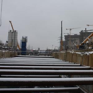
As mentioned above, on the territory of the Russian Plain there are no natural ones such as earthquakes and volcanic eruptions. Although some tremors (up to 3 points) are still possible, they cannot cause damage, and are recorded only by highly sensitive devices. The most dangerous natural phenomena that can occur on the territory of the Russian Plain are tornadoes and floods. The main environmental problem is the pollution of soil, rivers, lakes and the atmosphere with industrial waste, since many industrial enterprises are concentrated in this part of Russia.
Based on materials from the Great Encyclopedia of Russia
The Russian Plain is also called the East European Plain. This is its physical and geographical name. The total area of \u200b\u200bthis land area is 4 million km2. The largest is only the Amazonian lowland.
The East European Plain occupies a significant part of the territory of Russia. It starts off the shores of the Baltic Sea and ends near the Ural Mountains. From the north and from the south, the plain is limited by 2 seas at once. In the first case, these are the Barents and White Seas, in the second - the Caspian and Azov. The plain is bounded from different sides by mountain ranges. The situation is as follows:
- Northwest border - Scandinavian mountains;
- Western and southwestern borders - mountains of Central Europe and the Carpathians;
- Southern border - Caucasus Mountains;
- The eastern border is the Ural Mountains.
In addition, Crimea is located on the territory of the Russian Plain. In this case, the northern border from the foothills of the Crimean Mountains acts as the border.
Scientists attributed the East European Plain to the rank of physical and geographical countries due to the fact that it has the following characteristics:
- Placing a platform of the same name on one of the slabs, which, unlike the others, is slightly raised;
- Being in a temperate climatic zone, as well as a small amount of precipitation. This is a consequence of the influence of two oceans, the first of which is the Atlantic, the second is the Arctic;
- The presence of a clear natural zoning, which is explained by the flatness of the relief.
The described plain is divided into two other plains, namely:
- Basement denudation, occupying the Baltic crystalline shield;
- East European, located on two plates at once: Scythian and Russian.
The crystal shield has a unique relief. It was formed during continental denudation that lasted for thousands of years. Certain features were obtained by the relief as a result of tectonic movements that have occurred in recent times. As for the past, in the Quaternary period, the center of the glacier was located on the site of the modern Baltic crystalline shield. It is for this reason that the local relief is glacial.
Platform deposits, which are part of the Russian Plain, represent a kind of cover in a horizontal position. Thanks to them, the formation of two types of hills and lowlands took place. The first of them are layer-denudation, and the second are accumulative. In some parts of the plain, there are ledges of a folded basement. They are represented by basement-denudation heights and ridges: Donetsk, Timansky, etc.
If we take into account the average statistical indicator, then the height of the East European Plain above sea level is 170 meters. This indicator is the lowest on the coast of the Caspian Sea, and the highest - on the hills. For example, the Podolsk Upland is located 417 meters above sea level.
Settlement of the East European Plain
Some scientists are of the opinion that Eastern Europe was inhabited by Slavs, but some researchers are convinced of the opposite. It is known for certain that Cro-Magnons settled on the Russian Plain about 30 thousand years before our era. Outwardly, they slightly resembled Caucasians, and over time they became similar to modern people. The process of adaptation of Cro-Magnons took place in a glacier. In the 10th millennium BC, the climate became milder, so the descendants of the Cro-Magnons, called Indo-Europeans, began to develop the territories located in the southeast of modern Europe. Where they were earlier is unknown, but there is reliable data suggesting that the settlement of this territory by Indo-Europeans took place 6 thousand years before our era.
The first Slavs appeared on European territory much later than the Indo-Europeans. Historians claim that their active settlement falls on the 5th-6th centuries AD. For example, the Balkan Peninsula and the adjacent territories were occupied by the southern Slavs. The Western Slavs moved from north to west. Many of them became the ancestors of modern Germans and Poles. Some settled on the coast of the Baltic Sea, while others settled in the Czech Republic. At the same time, serious changes took place in the primitive society. In particular, the community outlived its usefulness, the clan hierarchy faded into the background, and associations that became the first states began to replace.
The Slavs settled without apparent difficulties eastern lands a large area called Europe. At first, their relationship with each other was based on the primitive communal system, and after - on the generic system. The number of settlers was small, so their tribes did not lack free lands.
In the process of settling, there was an assimilation of the Slavs with representatives of the Finno-Ugric tribes. Their tribal unions are considered the first similarities of states. In parallel with this, the climate of Europe has become warmer. This led to the development of agriculture and cattle breeding, but at the same time fishing and hunting continued to play an important role in the economic activities of primitive people.
The favorable coincidence of circumstances for the colonists explains that the Eastern Slavs became the largest group of peoples, including Russians, Ukrainians and Belarusians. If in the early Middle Ages the settlement of the Slavs only takes its beginning, but in the VIII century it "flourished". Simply put, it was at this time that the Slavic tribes were able to take a dominant position. Their neighbors were representatives of other nations. This has its pros and cons.
Speaking about the resettlement of the Slavs, it should be noted that main feature of this historical process - unevenness. First, the territories that were located near the path "from the Varangians to the Greeks" were developed, and only then the eastern, western and southwestern lands were colonized.
The settlement of the Slavs on the territory of the Russian Plain has a number of features. Among them it is necessary to highlight:
- Significant influence of climate on the duration of colonization;
- Dependence of population density on natural and climatic conditions. This means that the southern territories were populated more densely in comparison with the northern ones;
- Lack of military conflicts caused by lack of land;
- Levying tribute to other peoples;
- Complete assimilation of representatives of small tribes.
After the Slavic tribes occupied the East European Plain, they began to master new types of economic activity, made adjustments to the existing social system and created the prerequisites for the creation of the first states.
Contemporary exploration of the East European Plain
Many famous scientists were engaged in the study of the East European Plain. In particular, a huge contribution to the development of science was made by the mineralogist V.M. Severgin.
In the early spring of 1803, Severgin was studying the Baltic. While conducting research, he noticed that in the southwest direction from Lake Peipsi, the relief becomes more hilly. Subsequently, Vasily Mikhailovich made a multi-stage transition. First, he went from the Gauja River to the Nemunas, and then to the Bug. This allowed him to establish that the area is either hilly or elevated. Realizing that such an alternation is a regularity, Severgin unmistakably determined its direction, going from the southwest to the northeast.
The territory of Polesie was studied by scientists no less closely. In particular, numerous studies began after the lands on the right bank of the Dnieper "opened up", which led to a decrease in the number of meadows. So, in 1873, the Western Expedition was organized. A group of scientists led by topographer I.I. Zhilinsky planned to study the features of local bogs and determine the best ways to drain them. Over time, the members of the expedition were able to draw up a map of Polesie, studied lands with a total area of \u200b\u200bmore than 100 thousand km2 and measured about 600 heights. The information obtained by Zhilinsky allowed A.A. Tillo continue his colleague's endeavors. This led to the emergence of the hypsometric map. It served as a clear proof that Polesie is a plain with raised borders. In addition, it was found that the region is rich in rivers and lakes. There are about 500 of the first here, and 300 of the second. The total length of both is more than 9 thousand kilometers.
Later, G.I. Tanfilyev. He found that the destruction of the swamps would not cause the Dnieper to become shallow. P.A. came to the same conclusion. Tutkovsky. The same scientist finalized the map created by Tillo, adding several hills to it, among which the Ovruch ridge should be highlighted.
E.P. Kovalevsky, being an engineer at one of the factories in Lugansk, devoted himself to the study of the Donetsk ridge. He did a lot of research and determined that the ridge is a huge pool. Later, Kovalevsky was recognized as the discoverer of Donbass, because it was he who created his first geological map and suggested that this region is rich in minerals.
In 1840 the famous geologist R. Murchison came to Russia. Together with domestic scientists, he explored the coast of the White Sea. As a result of the work carried out, many rivers and hills were studied, which were then mapped.
The study of the southern part of the Russian Plain was carried out by V.V. Dokuchaev, who was later recognized as the "father" of Russian soil science. This scientist found that part of Eastern Europe is occupied by a unique zone, which is a mixture of black soil and steppe. In addition, in 1900 Dokuchaev drew up a map on which he divided the plain into 5 natural zones.
Over time, scientists' interest in the East European Plain has not weakened. This led to the organization of many expeditions and various studies. Both those and others made it possible to make many scientific discoveries, as well as create new maps.
The Russian plain is one of the largest plains on the planet. It is located in the eastern part of Europe, therefore its second name is the East European Plain. Since most of it is located on the territory of the Russian Federation, it is also called the Russian Plain. Its length from north to south is more than 2.5 thousand kilometers.
The relief of the Russian plain
This plain is dominated by a gently flat relief. There are many natural resources of Russia here. Hilly areas in the Russian Plain were formed as a result of faults. The height of some hills reaches 1000 meters.
The height of the Russian Plain is approximately 170 meters above sea level, but there are some areas that are 30 meters below sea level. As a result of the passage of the glacier, many lakes, valleys arose in this territory, some tectonic depressions expanded.
Rivers
The rivers flowing along the East European Plain belong to the basins of two oceans: the Arctic and the Atlantic, while others flow into the Caspian Sea and are not connected with the world's oceans. The longest river, the Volga, flows along this plain.
Natural areas
On the Russian Plain, there are all types of natural zones, as in Russia. There are no earthquakes or volcanic eruptions in this area. Tremors are quite possible, but they are not harmful.
The most dangerous natural phenomena in the East European Plain are tornadoes and floods. The main environmental problem is soil and atmosphere pollution with industrial waste. there are many industrial enterprises in this area.
Flora and fauna of the Russian Plain
There are three main groups of animals on the Russian Plain: arctic, forest and steppe. Forest animals are more common. Eastern species - lemmings (tundra); chipmunk (taiga); marmots and ground squirrels (steppes); saiga antelope (Caspian deserts and semi-deserts). Western species - pine marten, mink, forest cat, wild boar, garden dormouse, forest dormouse, hazel dormouse, black polecat (mixed and broad-leaved forests).
The fauna of the East European Plain is larger than any other part of Russia. Due to hunting and changes in the habitat of animals, many fur-bearing animals have suffered, because of their valuable fur, and ungulates because of their meat. River beaver and squirrel were trade items among the Eastern Slavs.
Until almost the 19th century, the wild forest horse, the tarpan, lived in mixed and deciduous forests. Bison are protected in the reserve of Belovezhskaya Pushcha, and beavers have been successfully raised in the Voronezh reserve. A variety of animals from Africa, Asia and Australia live in the Askania-Nova steppe reserve.
In the Voronezh regions, an elk appeared and a previously destroyed wild boar revived. Astrakhan Nature Reserve was created in the Volga delta to protect waterfowl. Despite bad influence man, the animal world of the Russian Plain is still great.