The equator is passing. The exact length of the earth's equator
Due to the spherical shape of the planet, this parallel is the longest.
2. In another way, the equator is a conditional line that runs exactly in the center of our planet. And it is she who is the longest road on Earth.
3. The line of the equator is longer than its counterpart, passing through the poles. The reason for this lies in the shape of our planet, which is slightly flattened due to rotation around its axis.
5. For scientists, the diameter of the Earth is of practical importance. It is calculated by knowing the equatorial circumference of the planet.

6. For the first time, the length of the equator was calculated by the ancient Greek mathematician and astronomer Erastofen Kirensky, and almost exactly. According to his data, the length of the earth's meridian is 250,000 stadia, that is, 40,000 kilometers. The exact length of the equator is 40,075,696 meters.
7. To pass the Earth on foot along the equator, you will need to overcome 40,075 km. The average pedestrian speed is 6 km / h. If you substitute these values into the formula, you get: 40075/6 = 6679 hours. After the transfer, it turns out 278 per day.
8.No one goes without stops. If you walk 6 hours a day, you will need 4 times more time - 1112 days. This will take 3 years.
9. Calculations are hypothetical, because the equator crosses land only through America, Africa, the Indonesian islands. The rest of the way lies across the oceans: Atlantic, Indian, Pacific.
10. There are 14 countries on the equator. But there is no traveler in the world who managed to cross all these countries along the equator.

ECUADOR
11. The name of the Latin American country Ecuador is translated from Spanish as "equator".
12. The equatorial line does not cross the territory of the country called Equatorial Guinea, despite its name.
13. In almost all equatorial countries, except for Gabon and Somalia, memorial signs have been erected in honor of the zero parallel. The most beautiful are in Brazil and Ecuador.
14. The zero parallel crosses 33 islands. Of these, 17 are the territory of Indonesia.
15. Some of the islands are not oceanic: 2 - in a lake on the Indonesian island of Kalimantan, 9 - at the mouth of the Amazon River, another 5 - on the African Lake Victoria.

16. The main international geographic organizations have adopted the symbolic form of the equator in the form of a circle.
17. The equator is the most important reference point for navigation - its latitude is 0 degrees, so the parallels are measured from it.

18. The equator is one of the five most important latitudes for navigation that are generally accepted in the geographic community. Four others: the Arctic Circle; The southern polar circle; Tropic of Cancer; Tropic of Capricorn.
19. The equator divides our planet into two almost equal hemispheres - Northern and Southern. Why almost? Because the shape of the earth is not a perfect ball.

21. If we take scientific concepts and numbers, then the Earth is not an ideal ball; in the world of experts, its shape is described by the concepts of a geoid or an ellipsoid.
22. The imperfection of the shape of our home planet was discovered back in the distant 17th century by Isaac Newton and Christian Huygens. Due to rotation around its axis and the resulting centrifugal force, which reaches a peak at the equator and zero at the poles, the planet rather has the shape of an oblate ball. Because of this, the polar radius is less than the equatorial one by 21.38 kilometers.

23. The planet reaches its highest rotation speed at zero latitude. This fact can be easily explained by the maximum radius of the Earth exactly at the equator.
24.So the length of the equator is equal to 40,075 kilometers, and if this number is divided by 24 hours (the time during which the planet makes one revolution), then you can find out the speed of rotation of the Earth at zero latitude. Thus, at the equator, it is approximately 1670 km / h.
25. That is, the speed of rotation of the Earth at the equator reaches 465 meters per second. This is more than the speed of sound, equal to 331 meters. The closer to the poles, the lower the speed.

CONGO RIVER
26. The Congo River, which flows in Central Africa, is the deepest and second longest in the continent. But the most interesting thing about it is that it is the only river in the world that crosses the equator twice.
27. There is a city in Brazil called Macapa. It is located simultaneously in two hemispheres. In the city center is the Estadio Milton Correa football stadium.
28.The center line of this stadium runs almost exactly along the line of the equator. Not far from the sports facility there is a monument “Marko Zero”.
29. Some countries get their name from the word “equator”: Ecuador, Equatorial Guinea, Equatorial Africa.
30. The Equator passes through the territories of many countries, however, it is not the hottest region on Earth - some remote deserts are much hotter.

31. To the north of the equator, the water flows clockwise when draining, and to the south - against it. And if you drain the water exactly at the equator, the water does not curl at all.
32. It was in this simple way that sailors in ancient times recorded the crossing of the equator. This is due to the influence of the Coriolis force. Translated from Latin, this word means "align".

33. In relation to the orbital plane, the equator position varies in the range of 22-24.5 °. The tilt of the axis is influenced by the attraction of the planets and the Sun.
34.Along the equator, day is equal to night without the slightest deviation. Twice a year at the equinox, the direction of the sun's rays is strictly vertical.
35. On other days, it is not much different, so the territories of the equator receive the largest amount of ultraviolet radiation.

36. According to the old maritime tradition, the Feast of Neptune was held by sailors of ancient times on ships crossing the equator.
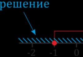
37. To carry out calculations, a conditional division of the planet into parallels and meridians is required. The geographic latitude of the equator is 0 °. This is the origin of all coordinates of the Earth, which divides it into 2 equal halves.
38. By parallels and meridians, the position of objects is determined. They are guided by them in the air, on land and in water. In addition, climatic zones, time zones are distinguished.

39. The area adjacent to the equator is characterized by a humid warm climate. Here the richest flora and fauna on the planet, dense forests, some areas are impassable.
40. The terms summer, autumn, winter and spring do not usually apply to this climatic zone. It is always summer here, the air is hot and humid due to constant evaporation. Summer here lasts a year, the average temperature is + 25 ... + 30 ° С. At night it is not much different from the daytime, so much the earth is warmed up by the sun. It rains almost every day.
41.The climate attracts tourists, but conditions are not created in all countries. The largest number of tourists is observed annually in the Maldives; the authorities of Ecuador, Brazil, Kenya attract tourists.

VOLCANO WOLF
42. The active volcano Wolf is located in the Galapagos archipelago. It is located on both sides of the equator.
43. Not far from the city of Quito (the capital of Ecuador) the Cayambe volcano glows white. Its height is 4690 meters, the slopes are covered with eternal ice.
44. The equatorial lowlands generally have a tropical rainforest climate, also known as the equatorial climate.
45. Average annual temperatures in the equatorial lowlands are around 31 ° C in the afternoon and 23 ° C at sunrise.

RAIN ON EQUATOR
46. The level of precipitation is extremely high in comparison with zones more distant from the equator - they can reach from 2500 to 3500 millimeters. There are about 200 rainy days a year, and the average annual number of hours of sunshine is about 2000.
47. Man uses the physical features of the zero parallel. The earth there rotates 1.4 times faster than the speed of sound. It is beneficial to launch space satellites in this region. They immediately gain supersonic speed, saving 10% of fuel.
48. Communication satellites in space are in geostationary orbit just above the equator, at an altitude of over 35,000 kilometers.
49. Objects moved from the poles to the equator lose 0.53% of their mass due to the centrifugal force and greater remoteness from the center of our planet.
50. It is the forests growing on the equator that are the “lungs of the Earth”, producing oxygen that all living things breathe.

EQUATORIAL FORESTS OF AFRICA
photo from open sources
For most of us equator Is nothing more than a symbolic line drawn on the map and denoting zero latitude. However, there are lucky ones who managed to see this very line drawn on the ground. The real center of the world is located in the Ecuadorian city Mitta del Mundo(translated from Spanish literally "the middle of the world"), here literally a stone's throw from the northern hemisphere to the southern.

The very name of the Republic of Ecuador in translation from Spanish means "equator", so the consonance is not accidental. The city of Quito, the capital of Ecuador, is indeed located on the equator, and the yellow line itself is in the “city” of Mitta del Mundo (located 15 km from Quito). Mitta del Mundo is actually more like a tourist center, no one lives here, but there is a lot of entertainment for travelers.

The symbolic yellow line appeared in Mitta del Mundo after the French geodetic expedition of Charles Marie de La Condamine in 1736. This enthusiastic scientist has been exploring Ecuador for 10 years, trying to find evidence that our planet is not perfectly flat, and at the same time to find the equator. And he succeeded, he found a point in the sky where the sun is at its zenith.

In 1936, the first monument in honor of the French Academy of Sciences appeared in Ecuador for the 200th anniversary of the expedition. And in 1979, Mitta del Mundo was turned into a tourist complex; the famous 30-meter tower topped with a globe was installed here, which does not cast a shadow on the days of the spring and autumn solstices. Along the alley leading to the monument, you can see the busts of all members of the expedition.

In addition to the tower, there are other attractions in Mitta del Mundo: a church in which newlyweds can get married, being in different hemispheres, and an ethnographic museum, whose expositions are dedicated to the peoples inhabiting Ecuador. About one and a half million tourists come to Mitta del Mundo every year. Despite the fact that the latest GPS studies have proved that the equator is actually located 240 meters north of the indicated yellow line, the Ecuadorian authorities decided not to move the monument, and, apparently, satisfied tourists are not too upset by this discrepancy.
The equator is an imaginary circular line that encircles the entire globe and runs through the center of the earth.
The equatorial line is perpendicular to the axis of rotation of our planet and is at an equal distance from both poles.
Equator: what is it and why is it needed?
So the equator is an imaginary line. Why would serious scientists need to imagine some lines outlining the Earth? Then, that the equator, like the meridians, parallels and other separators of the planet, which exist only in imagination and on paper, make it possible to make calculations, navigate in the sea, on land and in the air, determine the location of various objects, etc.

The Equator divides the Earth into the Northern and Southern Hemispheres and serves as the reference point for geographic latitude: the latitude of the equator is 0 degrees. It helps to navigate the climatic zones of the planet. The equatorial part of the Earth receives the largest amount of sunlight. Accordingly, the further territories are located from the equatorial line and the closer they are to the poles, the less sun they get.
The equatorial region is an eternal summer, where the air is always hot and very humid due to constant evaporation. At the equator, day is always equal to night. The sun is at its zenith - it shines vertically downward - only at the equator and only twice a year (on those days on which the equinoxes fall in most geographic zones of the Earth).

The equator passes through 14 states. Cities located directly on the line: Macapa (Brazil), Quito (Ecuador), Nakuru and Kisumu (Kenya), Pontinak (Kalimanta Island, Indonesia), Mbandaka (Republic of Congo), Kampala (capital of Uganda).
Equator length
The Equator is the longest parallel to the Earth. Its length is 40.075 km. The first who was able to approximately calculate the length of the equator was Eratosthenes, an ancient Greek astronomer and mathematician. To do this, he measured the time during which the sun's rays reached the bottom of a deep well. This helped him calculate the length of the radius of the Earth and, accordingly, the equator, thanks to the formula for the circumference.

It should be noted that the Earth is not a perfect circle, so its radius differs slightly in different parts of the mute. For example, the radius at the equator is 6378.25 km, and the radius at the poles is 6356.86 km. Therefore, to solve problems of calculating the length of the equator, the radius is taken equal to 6371 km.
The length of the equator is one of the key metric characteristics of our planet. It is used for calculations not only in geography and geodesy, but in astronomy and astrology.
What the equator is, I learned early, even from my first children's atlases, but it did not arouse keen interest in me then.
A little later, when I became interested in the nature of South America, my interest in this issue increased sharply. After all, the equator passes through three South American countries: Ecuador, Brazil and Colombia.
General information about the equator
Officially, we can say that: "The equator is a section line of the Earth passing through the center of the Earth and perpendicular to the axis of its rotation. "
I'll just tell you that if our planet is like a watermelon, horizontally and evenly to cut in half, then on the section there will be an equator, which passes through: the Atlantic, Indian and Pacific oceans, as well as more than a dozen states in Africa, Asia and both Americas

Interesting that:
- hemispheres separated from each other precisely equator;
- length of the equator more than forty thousand kilometers;
- equator impossible to touch, in fact it is only a mark on the cards.
Weather and climate
The climate is humid tropical.
He is characterized by:

If at the poles night and day can last almost six months, then at the equator they always last exactly twelve o'clock.
Nature and ecology
Equatorial belt rich in his rainforest... It is home to many species of flora and fauna. The variety of life forms is amazing. Think of the African jungle and the Amazonian jungle - how many unusual and amazing animals and plants there are!

Unfortunately, it is these forests that have become the main victims of the massive deforestation. Violation of this unique ecosystem leads to the death of many species of flora and fauna. It is absolutely impossible to overestimate the importance of these forests for all of us, because they can rightfully be considered the "lungs" of our planet.
And even though most of us live far from the equator, any forests are important for all of us! This should be remembered and everything possible should be done to forests have not disappeared from the face of the earth.
Helpful 0 0 Not very
Friends, you often ask, so we remind you! 😉
Flights- you can compare prices from all airlines and agencies!
Hotels- don't forget to check prices from booking sites! Don't overpay. It !
Rent a Car- also aggregation of prices from all distributors, all in one place, let's go!
When I start to remember how I learned about the equator, several associations from a fairly early childhood come to mind. But the most striking one is connected with the cartoon about Captain Vrungel. When his yacht crossed the zero parallel, the captain, according to the old maritime custom, threw a holiday of Neptune, which caused some confusion among the ignorant crew members (they decided that Vrungel was overheated in the sun). Probably, then I wondered what kind of place this "equator" is.

What is the equator
This is a fictional line running exactly between the two poles of the planet and at the same time perpendicular to the axis of rotation... So she divides the Earth into two hemispheres: Northern and Southern.
But, despite its immateriality, the equator can still be seen. This line turns out the closest part of the planet to the Sun, which means the warmest. Therefore, it is enough to look at the map of the Earth to see how juicy green tropical forests (they are also called equatorial) "outline" a kind of vegetative equator.

Equatorial forests
The kingdom of evergreen trees with beautiful glossy leaves. By the way, gloss is not here for beauty. Rainforests are always very humid, so plants have learned to produce a special wax that covers the leaves with a thin film, it protects them from decay. From such "waxed" beauties, water rolls down like an umbrella.
Nowhere else on the planet you will find trees, flowers and fruits of which grow right on the trunk. This phenomenon even received a special name - caulifloria.

But like any forest on Earth, the tropical one also has tiers:

Helpful 0 0 Not very
Comments0
I received the minimum set of knowledge about the equator during my school years in geography lessons. While equator I associated with the hottest place on the planet, where the sun is constantly shining, where exotic fruits grow and amazing animals live. What is the equator?

Equator - Earth's circumference line
It is a circular line passing through the entire globe perpendicular to the axis of its rotation, and located at the same distance from the poles.

What is the equator for?
Time equator - imaginary line, then the question immediately arose, why then it was necessary for scientists to imagine him?
- Thanks to the equator, like other imaginary lines (meridians, parallels), it is possible to very accurately determine the location of all objects, regardless of where they are (at sea, on land or even in the air).
- The equatorial line divides the planet into two parts: the Northern and Southern hemispheres.
- Thanks to the equator, it is easy to navigate the climatic zone. Territories that are located in the immediate vicinity of it receive maximum amount of sun and heat, here is an eternal summer! As you move away from here to the poles, you can notice a significant reduction in sunlight reaching the Earth's surface, respectively, with distance from the equator, the climate becomes colder and colder. I live in central Russia, where even in summer it is not always warm and sunny. Therefore, I am very attracted to hot countries located in the equatorial region.

How long is the equator
Equator can be called longest parallel. Its length was first calculated in Ancient Greece. It was the scientist Eratosthenes. He watched the sun's rays penetrating into a deep well. By measuring the time it takes for the rays to reach the bottom, he was able to determine the size of the radius of our planet, and then equatorial length... Such an approximate calculation gave a very accurate result - 40075 km This parameter of the Earth is one of the key metric characteristics that are actively used in geodesy, astronomy and astrology.
Helpful 0 0 Not very
Comments0
One of my favorite topics in school in geography lessons was the calculation of geographic coordinates. In order to find the exact coordinates of the points, I looked for the equator and the prime meridian. It was about then that I began to think about how people live at the equator, because the Northern and Southern Hemispheres are fundamentally different from each other. If in the north of the equator it is summer, then in the south at the same time it is winter. Of course, this happens only in theory, but in life, the climate at the equator does not change at all.

What is the equator
When I hear the word equator, then immediately present a geographic map with a clear a straight line in the middle... In practice, this is completely different, because equator- only conventional lineI which divides the Earth into two equal parts... From latin "Aequator" denotes Equalize... Scientists call the equator a conditional line that passes through the center of the Earth parallel to the axis of its rotation... Thanks to mathematical calculations, it was found that equator lengthbut is 40 075, 676 km.

Where is the equator
The equator line is the beginning latitude reference... It passes through such large countries:

A bit of history
Even the ancient Egyptians sailed along the coast in the Mediterranean Sea. Phoenicians the first went beyond its limits through the Pillars of Hercules (the so-called Strait of Gibraltar) into the open waters of the Atlantic Ocean. They are dwere guessing about the existence of the equator, but also could not calculate its length... Phoenicians crossed the equator line and swam almost to the southern part of Africa. A cave drawing has survived to this day in Namibia "White Lady Brandberg» .

Age of Discovery
After the discovery of America by Columbus, large-scale voyages of Europeans in the World Ocean began. Sea routes to India and Australia were opened. F. Magellan was the first to float over the territory of the globe. During your journey Magellan could not sail strictly along the equatoRU... The geography of the oceans did not allow this. During the first round the world trip already the existence of the equator has been proven... The sailors used the data of the ancient Greek mathematician Eratosthenes about the length of the equator line.

Thanks to the equator, we can calculate the exact coordinates of any point on the earth's surface. This conditional line helps navigate climatic zones and natural zones... Exactly equatorial latitudes receive the most plenty of sunlight and heat.
Helpful 0 0 Not very
Comments0
I remember at the age of 5, my friends and I learned from older comrades that there is a country where it is always warm and always summer. That was a surprise, only kids who know the world, and enthusiastic exclamations: "If only we could do it!" Much later, at school, we realized that the name of this "super-country" is the equator (our school friends then meant it). The task of marking the equator on contour maps still evokes nostalgia when I look at them. And in his student years, the equator, as the half of the training passed, had a completely different meaning :). But now we are talking about him from the point of view of geographical representations.

Equator: definition and characteristics
As on the geometric ruler, zero is the reference point, so the equator is the reference point for geographical latitude. Its latitude is zero. It figuratively divides the planet Earth into two hemispheres (Southern, Northern) and perpendicular to the axis of rotation. Interesting features of zero latitude:
- for there is real terrain in the path of the imaginary line. The zero parallel crosses three continents (Asia, South America, Africa), three oceans (Pacific, Atlantic, Indian), 13 countries;
- the zones near the equator are called the tropics. There really is always summer. Warm, humid air. Day is invariably equal to night;
- this unique part of the Earth, in comparison with others, receives the largest amount of radiation from the Sun;
- thanks to the constant heat of the sun and rain, for a tropical climate very lush vegetation is characteristic.

The equator was known before our era
The knowledge of this fact once again makes one admire, indeed, the greatest wisdom of ancient scientists. As one of my teachers put it: "It is easy to make discoveries, having a number of tools to achieve the goal, but make at least one discovery using only your mind." And they could.
More than 2000 years ago, the ancient Greek philologist, geographer, mathematician, astronomer - Eratosthenes of Cyrene was able to calculate the length of the radius of our planet and its circumference. The data he received differs very slightly from the modern ones! Scientists say the length of the equator is 40,075 km, Eratosthenes "counted" about 39,500 km. Press "Enter" to comment
I always like to start with the origin and translation of a word, because usually this is the main meaning. Translated from Latin word"equator" means « align, equalize". That is, the very word "equator" is something separating and leveling.
There are many common expressions for the word equator. For example, the equator of a college degree represents half of the course of study completed. But I will return to the most common meaning of this term, namely, to the geographic equator!
What is the equator of the Earth
If we talk about the equator of the Earth, then it is equidistant from both poles imaginary plane which divides our The earth, cuts it like an apple into two equal halves - Southern and Northern Hemisphere!

- At the equator the length of the day and night are the same- it struck me the most!
- At the equator at noon items and people do not cast shadows on the days of the equinox- feel like a vampire!
- Than closer to the equator, the less you will weigh, since gravity decreases!
- At the equator our the planet is spinning faster! This rotation speed is almost one and a half times higher than the speed of sound in air!
- Equator line closest to the sun so there warmest on earth, but nevertheless it is on the equator line at an altitude of 4690 meters situated glacier!

In the world exists several monuments to the equator! The most famous of them are - Marco Zero in Brazil and a monument called "Middle of the World" in Ecuador.

Not in vain in Ecuador decided to build equator monument, because the country owes its name to him! In the name of the opportunity to be photographed on the famous yellow line, crowds of tourists flock to. But, in fact, the real line of the equator in Ecuador runs a little further - on the territory of the Intiñan museum, but tourists usually do not bother!
Why did they introduce the designation of the equator
Determining the equator helps with mapping, determination of coordinates, orienteering and even launching satellites! With the approach to the equator, climatic and physical conditions change so much that you do not have time to be surprised at the diversity of our planet!
Helpful 0 0 Not very
For scientists, the diameter of the Earth is of practical importance. It is calculated by knowing the equatorial circumference of the planet.
Basic parameters of the Earth
The planet Earth is at least 4.5 billion years old. It is included in the terrestrial group of planets along with Mercury, Venus and Mars. Unlike gas giants (Jupiter, Saturn, Neptune, Uranus), they are composed of rocks that cover the surface with a thin layer. Among the planets of the terrestrial group, the Earth is the largest, and in the solar system, the fifth largest.
The main difference between the Earth is that it is the only one on which there is life. This is facilitated by:
- Distance from the Sun, which is approximately 150 million km.
- Surface temperature: average + 13 ° С, minimum does not exceed -90 ° С, maximum - + 60 ° С.
- Water - the basis of life - occupies 71% of the area.
- The composition of the atmosphere: 78% nitrogen, 21% oxygen, 1% argon.
In terms of physical parameters, the Earth surpasses all the planets of the terrestrial group:
- the mass is 5.9722 ± 0.0006 × 1024 kg;
- volume - 1.08321 × 10¹² km³;
- density - 5.514 × 10 g / cm³;
- equatorial circumference - 40075.16 km, diameter - 12756.1 km;
- the parameters are smaller between the poles: circumference - 40008 km; diameter - 12,713.5 km.
The densest Earth because it is the only one with a solid inner core, which occupies about 30% of the volume. It is covered with a liquid mantle (70-80% of the volume) and bark (1%).
The Earth has 1 satellite - the Moon, the average distance to which is 384.4 thousand km. In an orbit of 939120 million km, the planet orbits the Sun in 365.3 days. Around its own axis - in 23.9 hours.
Planet shape
Our planet is called a ball, but this is wrong from the point of view of geometry. It's not about ocean trenches and mountain peaks - for a global scale, the difference between them is insignificant. Between the lowest point (Mariana Trench) and the highest (Mount Everest) - 19 km.
Gravity affects the shape of the Earth more. The mass is attracted to the center (core), which is why the celestial body is compressed, acquiring a spherical shape. The centrifugal force generated by the rotation of the planet is highest at the equator. Under its influence, this area is the largest in circumference and diameter.
What is the equator and why is it needed
Equator is a conditional line perpendicular to the axis of rotation along the Earth at an identical distance from the poles. Due to the spherical shape of the planet, this parallel is the longest. In relation to the orbital plane, the position of the equator varies in the range of 22-24.5 °. The tilt of the axis is influenced by the attraction of the planets and the Sun.
Along the equator, day is equal to night without the slightest deviation. Twice a year at the equinox, the direction of the sun's rays is strictly vertical. On the rest of the days, it is not much different, so the territories of the equator receive the largest amount of ultraviolet radiation. It is always summer here, the air is hot and humid due to constant evaporation.
To carry out calculations, a conditional division of the planet into parallels and meridians is required. The geographic latitude of the equator is 0 °. This is the origin of all coordinates of the Earth, which divides it into 2 equal halves.
The position of objects is determined by parallels and meridians. They are guided by them in the air, on land and in water. In addition, climatic zones, time zones are distinguished.
How to measure the circumference of the earth
To measure the circumference of the earth along the equator, there are special instruments and space satellites. But, applying knowledge of geometry, they get data without complicated tools. For the first time such work was performed by the scientist of Ancient Greece Eratosthenes.
According to legend, the travelers told him that on the day of the summer solstice, they watched the bottom of the deepest wells illuminated, and objects did not cast shadows. The sun was at its zenith. This took place 500 miles south of Alexandria, in Siena. The astronomer knew that in his hometown, objects cast a shadow, and the sun did not look at the bottom of deep wells.
At noon on the longest summer day, Eratosthenes measured the length of the shadow of the city obelisk, he knew the height. Based on these data, he calculated the length of the conditional line connecting the tops of the obelisk and the shadow. Knowing these data, I calculated the angles of an imaginary triangle - 7 °. This meant that Siena was so biased in relation to Alexandria.
An angle of 7 ° is approximately ⅟50 of a closed circle, which is always 360 °. The astronomer continued his calculations further. He multiplied the distance to Siena by 50. The result is the circumference of the Earth - 25,000 miles. Modern research has shown that the scientist was not very wrong: the equatorial circumference of the planet is 24894 miles or 40,075 km.
The error of Eratosthenes is not due to the primitiveness of the calculations that he used. This method is accurate, it is still used today, only with more sophisticated instruments. The scientist did not know the exact distance between the cities. In those days, it was measured by the number of days spent by the caravan on the way.
The second reason for the inaccuracy is that Alexandria and Siena are located on different meridians. Today, the circumference is calculated between objects that are on the same meridian.
Radius and Diameter Calculations
Knowing the circumference, it is not difficult to calculate the radius and diameter of the globe. Apply the formulas: d = l / π; r = ½ * π. Letters indicate:
- d - diameter. Connects opposite sides of the circle, passes through the center.
- l is the circumference. This is a line equidistant from the center.
- r is the radius. This is the name of the line drawn from the center to an arbitrary point on the circle.
- π is a number equal to 3.14. It is infinite, so the more digits after the decimal point, the more accurate the calculations.
It is not necessary to use both formulas. Diameter and radius are related. One parameter is calculated, after which the second is recognized: the diameter is 2 times the radius and vice versa.
The size of the circle is different at the equator and poles. Therefore, the equatorial radius is greater than the polar one. The first is 6378 km, the second is 6356 km. Interestingly, the diameter of the Sun is 109 times the diameter of the Earth.
How long does it take to get around the planet on foot
Equatorial circumference in kilometers is calculated. Knowing this value and the estimated speed of the pedestrian, they determine how long it will take to go around the Earth. The formula is applied: t = S: V. Latin letters mean:
- t is time;
- S - path;
- V is the speed.
To traverse the Earth on foot along the equator, you will need to overcome 40,075 km. The average pedestrian speed is 6 km / h. If you substitute these values into the formula, you get: 40075/6 = 6679 hours. After the transfer, it turns out 278 per day.
No one goes without stopping. If you walk 6 hours a day, you will need 4 times more time - 1112 days. This will take 3 years.
The calculations are hypothetical, because the equator crosses land only through America, Africa, and the Indonesian islands. The rest of the way lies across the oceans: Atlantic, Indian, Pacific.
Interesting facts about the Earth's equator
The equator crosses 33 islands. Credit: reader.lecta.rosuchebnik.ru.
The area adjacent to the equator is characterized by a humid warm climate. Here the richest flora and fauna on the planet, dense forests, some areas are impassable. Summer lasts a year, the average temperature is + 25 ... + 30 ° С. At night it is not much different from the daytime, so much the earth is warmed up by the sun. It rains almost every day.
The climate attracts tourists, but conditions are not created in all countries. The largest number of tourists is observed annually in the Maldives; the authorities of Ecuador, Brazil, Kenya attract tourists.
The geographical sights of the equatorial countries are interesting:
- The zero parallel crosses 33 islands. Of these, 17 are the territory of Indonesia. Some of the islands are not oceanic: 2 - in the lake on the Indonesian island of Kalimantan, 9 - at the mouth of the Amazon River, 5 more - on the African Lake Victoria.
- There are 14 countries at the equator. Ecuador is named after him, which is crossed by the zero parallel. There is no traveler in the world who managed to cross all these countries along the equator.
- Almost all equatorial countries, except Gabon and Somalia, have memorial signs in honor of the zero parallel. The most beautiful are in Brazil and Ecuador.
- The active volcano Wolf is located in the Galapagos archipelago. It is located on both sides of the equator.
- Not far from the city of Quito (the capital of Ecuador) the Cayambe volcano glows white. Its height is 4690 m, the slopes are covered with eternal ice.
- The Congo River in Africa crosses the equator 2 times.
The person uses the physical features of the zero parallel. The earth there rotates 1.4 times faster than the speed of sound. It is beneficial to launch space satellites in this region. They immediately gain supersonic speed, saving 10% of fuel. Communication satellites hovered in geostationary orbit above the equator. The signal reaches the Earth faster than in other regions.