Geography presentation on the theme: "Inland waters of Eurasia" (grade 7). Presentation "Inland waters of Eurasia" Download presentation Inland waters of Eurasia
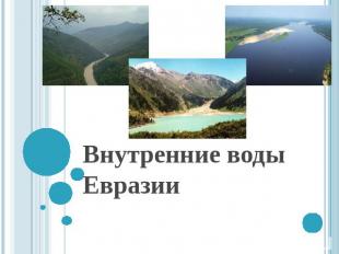
Slide 1
Slide 2
 General characteristics of the water balance of the territory On the surface of Eurasia, about 40 thousand km of precipitation falls, 23.5 thousand km of this amount is spent on evaporation. The annual runoff from the territory of Eurasia together with the islands is more than 16 thousand km, i.e. slightly less than half of the total runoff of all rivers on Earth. In terms of the drainage layer, this is equal to 300 mm, i.e. above the average for the entire Earth as a whole. In terms of the average runoff layer thickness, Eurasia is surpassed only by South America. However, these average values \u200b\u200bby no means fully reflect the peculiarities of the distribution of inland waters within the continent.
Slide 3
 Significant differences in structure and relief, climatic contrasts and the associated uneven precipitation and differences in evaporation create large differences in the distribution of both surface and groundwater within the continent. The maximum amount of runoff (more than 1500 mm) is typical for the subequatorial and equatorial belt, especially for the islands of the Sunda archipelago, for the west of Indochina and Hindustan, and for the central part of the Himalayas. In other belts, such high amounts of runoff are characteristic only for a few regions of the Japanese Islands, the Alps, and the Scandinavian Highlands.
Slide 4
 Large spaces in the same regions have an annual flow of less than 1500 but more than 600 mm. In most of Europe, in North and East Asia, the annual flow is between 200 and 600 mm per year. For relatively small areas of the Iberian Peninsula, the Danube Plains, the middle part of the East European Plain, and other regions, a runoff of less than 200 mm is characteristic, i.e. slightly less than the average for the entire land. The vast territories of Central and Central Asia, the basin of the lower Indus, the Iranian Highlands and the Arabian Peninsula have a flow rate of less than 50 mm per year, and in many regions the layer thickness does not exceed 15 mm. These figures reflect to a certain extent the differences in the density and nature of the surface water network in different parts of the continent.
Slide 5
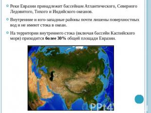
 The rivers of Eurasia belong to the basins of the Atlantic, Arctic, Pacific and Indian oceans. The interior and southwestern regions are almost devoid of surface water and have no drainage into the ocean. The territory of the internal flow (including the Caspian Sea basin) accounts for over 30% of the total area of \u200b\u200bEurasia.
Slide 6
 The uneven distribution of water surfaces depends not only on modern natural conditions, but also on the characteristics of the development of the continent. Obviously, before the powerful uplifts that led to the formation of the highest mountain ranges in the southern part of the continent, the climatic conditions of the inner parts of Eurasia, although they were more dry than the climates of its outskirts, were not as arid as they are now. In this regard, in the Cenozoic in the central part of the continent, there was a developed network of rivers and lakes, which had a flow to the north, east and south. Tectonic movements, which had a greater scope in the marginal parts of the orogenic belt than in the interior regions, led to the fact that these regions were fenced off from the influence of the oceans. The associated drying out of the climate led to a decrease and disorganization of surface runoff and the formation of vast areas in the interior of the Eurasian continent (Iranian Highlands, Tibet, plateaus of China, Mongolia, etc.), practically devoid of surface runoff.
Slide 7
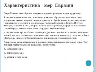
 Characteristics of Eurasian lakes Eurasian lakes are diverse in origin, size and water regime. 1.glacial tectonic; the basins of these lakes are formed by tectonic cracks of the Neogene-Anthropogenic time and processed by glaciers, have irregular outlines and significant depths. (For example: Venern, Vettern, Mälaren, Payanne, Saima, Inari). In the more southern regions, within the Baltic lake ridge, there are accumulations of dammed moraine lakes. 2. glacial lakes are especially characteristic of the Alps. The basins of the world famous alpine lakes were laid in tectonic depressions at the end of the Neogene, and then were processed and deepened by powerful glaciers descending from the mountains. 3. Karst lakes were formed as a result of leaching of limestone rocks. This type of lake is common in the Balkan Peninsula. 4. dammed lakes 5. floodplain lakes 6. volcanic lakes
Slide 8
 The modern glaciation of Eurasia The modern glaciation of Eurasia is associated, on the one hand, with the islands of the Arctic and Subarctic, on the other, with the highest and most abundantly irrigated mountain systems. The polar islands are characterized by glaciation of the cover type and a low position of the snow boundary. On Svalbard, it lies on average at an altitude of 300 m above sea level. Glaciation has the character of shields, from which powerful glacial tongues descend, breaking off into the sea. A large center of glaciation is located on the island of Iceland, where the position of the lower boundary of the nival belt varies between 700 and 1000 m. All mountain ranges are covered with firn fields, from which glaciers feed numerous rivers.
Slide 9
 Modern glaciation of Eurasia In the mountains, the height of the snow boundary rises from north to south and from the marginal parts of the continent to the inland regions. Therefore, large centers of modern glaciation are not only the highest mountain systems, such as the Kunlun, Karakorum, Himalayas, Tien Shan, but also much less high, but abundantly humid mountains of the Atlantic regions. In the Scandinavian mountains, where the height of the snow line varies between 700 and 1900 m, there is significant glaciation. In the Alps, the snow boundary rises to a height of 2500-3200 m; it is the largest center of mountain glaciation in Europe with a valley type of glaciers, from which almost all significant rivers of Europe or their tributaries (Rhine, Rhone, Po, Danube tributaries) originate.
Slide 10
 The modern glaciation of Eurasia The modern glaciation of the mountains of Asia, although significant, is still not as great as it could be, judging by their height. The highest mountains rise in the interior regions of the continent, characterized by a sharp continental climate and low precipitation, so the snow border and the lower ends of the glaciers lie at a high altitude. The height of the snow border of the Karakorum, Kunlun is 5000-5500 m. The Himalayas are 4500-5000 m. The length of individual glaciers in Karakorum reaches 60 km, the maximum length of the glaciers on the southern slope of the Himalayas is 26 km. In the Eastern Tien Shan, the height of the snow border is 3700 m and the length of the largest glacier is 40 km.


1 out of 10
Presentation on the topic:
Slide No. 1
Slide Description:
Slide No. 2

Slide Description:
About 40 thousand km of precipitation falls on the surface of Eurasia, 23.5 thousand km of this amount is spent on evaporation. The annual runoff from the territory of Eurasia together with the islands is more than 16 thousand km, i.e. slightly less than half of the total runoff of all rivers on the Earth. In terms of runoff layer, this is equal to 300 mm, i.e. above the average for the entire Earth as a whole. In terms of the average runoff layer thickness, Eurasia is surpassed only by South America. However, these average values \u200b\u200bby no means fully reflect the peculiarities of the distribution of inland waters within the continent.
Slide No. 3

Slide Description:
Significant differences in structure and relief, climatic contrasts and the associated uneven precipitation and differences in evaporation create large differences in the distribution of both surface and groundwater within the continent. The maximum amount of runoff (more than 1500 mm) is typical for the subequatorial and equatorial belt, especially for the islands of the Sunda archipelago, for the west of Indochina and Hindustan, and for the central part of the Himalayas. In other belts, such high amounts of runoff are characteristic only for a few regions of the Japanese Islands, the Alps, and the Scandinavian Highlands.
Slide No. 4

Slide Description:
Large spaces in the same regions have an annual flow of less than 1500 but more than 600 mm. In most of Europe, in North and East Asia, the annual flow is between 200 and 600 mm per year. For relatively small areas of the Iberian Peninsula, the Danube Plains, the middle part of the East European Plain, and other regions, a runoff of less than 200 mm is characteristic, i.e. The vast territories of Central and Central Asia, the basin of the lower Indus, the Iranian Highlands and the Arabian Peninsula have a flow rate of less than 50 mm per year, and in many regions the layer thickness does not exceed 15 mm. These figures reflect to a certain extent the differences in the density and nature of the surface water network in different parts of the continent.
Slide No. 5
Slide Description:
The rivers of Eurasia belong to the basins of the Atlantic, Arctic, Pacific and Indian oceans. The interior and southwestern regions are almost devoid of surface water and have no drainage into the ocean. The territory of the internal flow (including the Caspian Sea basin) accounts for over 30% of the total area of \u200b\u200bEurasia.
Slide No. 6

Slide Description:
The uneven distribution of water surfaces depends not only on modern natural conditions, but also on the characteristics of the development of the continent. Obviously, up to the powerful uplifts that led to the formation of the highest mountain ranges in the southern part of the continent, the climatic conditions of the inner parts of Eurasia, although they were more dry than the climates of its the outskirts, nevertheless, were not as arid as at present. In this regard, in the Cenozoic in the central part of the continent, there was a developed network of rivers and lakes, which had a flow to the north, east and south. Tectonic movements, which had a greater scope in the marginal parts of the orogenic belt than in the interior regions, led to the fact that these regions were fenced off from the influence of the oceans. The associated drying out of the climate led to a decrease and disorganization of surface runoff and the formation of vast areas in the interior of the Eurasian continent (Iranian Highlands, Tibet, plateaus of China, Mongolia, etc.), practically devoid of surface runoff.
Slide No. 7
Slide Description:
Characteristics of Eurasian lakes Eurasian lakes are diverse in origin, size and water regime. 1. glacial tectonic; the basins of these lakes are formed by tectonic cracks of the Neogene-Anthropogenic time and processed by glaciers, have irregular outlines and significant depths. (For example: Venern, Vettern, Mälaren, Payanne, Saima, Inari). In more southern regions, within the Baltic Lake Ridge, there are accumulations of dammed moraine lakes. 2. glacial lakes are especially characteristic of the Alps. The basins of the world famous alpine lakes were laid in tectonic depressions at the end of the Neogene, and then were processed and deepened by powerful glaciers descending from the mountains. karst lakes were formed as a result of leaching of limestone rocks. This type of lake is common in the Balkan Peninsula. 4. dammed lakes 5. floodplain lakes 6.volcanic lakes
Slide No. 8

Slide Description:
The modern glaciation of Eurasia The modern glaciation of Eurasia is associated, on the one hand, with the islands of the Arctic and Subarctic, on the other, with the highest and most abundantly irrigated mountain systems. The polar islands are characterized by glaciation of the cover type and a low position of the snow boundary. On Svalbard, it lies on average at an altitude of 300 m above sea level. Glaciation has the character of shields, from which powerful glacial tongues descend, breaking off into the sea. A large center of glaciation is located on the island of Iceland, where the position of the lower boundary of the nival belt fluctuates between 700 and 1000 m. All mountain ranges are covered with firn fields, from which glaciers feed numerous rivers.
Slide No. 9

Slide Description:
Modern glaciation of Eurasia In the mountains, the height of the snow boundary rises from north to south and from the marginal parts of the continent to the inland regions. Therefore, large centers of modern glaciation are not only the highest mountain systems, such as the Kunlun, Karakorum, Himalayas, Tien Shan, but also much less high, but abundantly humid mountains of the Atlantic regions. In the Scandinavian mountains, where the height of the snow line varies between 700 and 1900 m, there is significant glaciation. In the Alps, the snow boundary rises to a height of 2500-3200 m; it is the largest center of mountain glaciation in Europe with a valley type of glaciers, from which almost all significant rivers of Europe or their tributaries (Rhine, Rhone, Po, Danube tributaries) originate.
Slide No. 10

Slide Description:
The modern glaciation of Eurasia The modern glaciation of the mountains of Asia, although significant, is still not as great as it could be, judging by their height. The highest mountains rise in the interior regions of the continent, characterized by a sharp continental climate and low precipitation, so the snow border and the lower ends of the glaciers lie at a high altitude. The height of the snow border of the Karakorum, Kunlun is 5000-5500 m. The Himalayas are 4500-5000 m. The length of individual glaciers in Karakorum reaches 60 km, the maximum length of the glaciers on the southern slope of the Himalayas is 26 km. In the Eastern Tien Shan, the height of the snow border is 3700 m and the length of the largest glacier is 40 km.
Description of the presentation for individual slides:
1 slide
Slide Description:
2 slide

Slide Description:
Goals and objectives of the lesson: To form an idea of \u200b\u200bthe general features of the inland waters of Eurasia. To acquaint students with the largest rivers and lakes of the mainland. Form the concepts: territories of internal flow, permafrost. By comparing the characteristics of various rivers, develop the ability to compare nature and phenomena, draw conclusions based on the analysis of geographical knowledge. Fostering a respectful attitude to the natural resources of the earth.
3 slide

Slide Description:
Equipment: Physical map of Eurasia; handout material with reference material.
4 slide

Slide Description:
Characteristic features of the rivers of Eurasia. 1. The vastness of the mainland has created conditions for the formation of large rivers. 2. Diversity of climate and topography caused differences in the sources of food and regime of these rivers. 3. Huge area of \u200b\u200binternal drainage basins.
5 slide

Slide Description:
Rivers of Eurasia Belong to the basins: the Arctic Ocean; The Atlantic Ocean; The Pacific Ocean; Indian Ocean; internal drain.
6 slide

Slide Description:
The rivers of the Arctic Ocean basin Northern Dvina, Ob with Irtysh, Yenisei with Angara, Lena with Aldan. Snow nutrition predominates. Freeze for a long time in winter, overflow in spring
7 slide

Slide Description:
River - Lena and the mighty Yenisei The largest rivers of Siberia, the Lena and Yenisei, are rich in energy and fish. A huge amount of minerals is mined on the banks of the rivers, large enterprises have been built. On the river from the side of the seas of the Arctic Ocean, timber rafting is conducted.
8 slide

Slide Description:
The rivers of the Atlantic Ocean basin are a dense river network, many lakes. Food in the west (Seine, Rhine) - rain (sea climate), rivers do not freeze, navigable all year round. In the east - food is mixed (Elbe, Oder, Vistula), does not freeze for long, spring floods. They are navigable in warm seasons. The rivers of the Mediterranean basin are fed by rain (in winter) and dry up in summer. In the Alps, the rivers are fed by glacial and snow.
9 slide

Slide Description:
The rivers of the Atlantic Ocean Basin Danube is the most important shipping artery in Europe, a source of energy and simply one of the most beautiful rivers in the world.
10 slide

Slide Description:
The Danube River (the ancient name of the Istres) on its way from its source in Germany to its mouth in the Black Sea flows through 10 countries: Germany, Austria, Slovakia, Hungary, Croatia, Serbia, Bulgaria, Romania, Moldova, Ukraine. The fate of many European states was decided on its shores. Where it flows: The Danube is formed by the confluence of the Breg and Brigach rivers, near the town of Dronaueschinger in Germany at an altitude of 678 m. It is the second largest river in Europe after the Volga. On its banks are located such European capitals as: Bratislava, Vienna, Budapest, Belgrade. In Romania, it flows into the Black Sea, forming a large delta. Even in ancient times, the Danube served as a transport artery. Danube length: 2860 kilometers.
11 slide

Slide Description:
Danube tributaries: Iller, Lech, Izar, Inn, Ens, Morava, Raba, Vag, Hron, Ipel, Drava, Tisza, Sava, Morava, Iskar, Siret, Prut. others. The intensive use of the river has upset the ecological balance and the number of fish in the Danube has significantly decreased. Other environmental problems can also be added here: the drying up of floodplain forests, the extinction of animals that traditionally lived on the banks of the river. Food method: The Danube has different food sources. The main source of water is melted snow from the mountains. Rainwater and groundwater also play an important role. Freezing: High water occurs in spring and summer, from late February to August. The least water is in the Danube in September October. The river does not freeze every year (in January-February).
12 slide

Slide Description:
The Rhine River (translated from Celtic means “current”) is also one of the most significant rivers in Europe. The length from source to mouth is 1320 km. The catchment area is 251800 km2. sq. Where it flows: The Rhine originates in the Alps at an altitude of 2000 meters above sea level. The river flows through the territories of such Western European countries as Switzerland, Liechtenstein, Austria, Germany, France, the Netherlands. It is formed from the confluence of two mountain rivers and has a mountainous character in the upper reaches. After the city of Basel, the river sharply changes its direction and rushes north. The area between Basel and Lake Constance is called the Rhine Mountain. located below sea level. Before flowing into the North Sea, the Rhine forms a delta splitting into many branches.
13 slide

Slide Description:
Tributaries: Neckar, Mine, Ruhr, Aare, Moselle. Cities on the Rhine: Arnhem, Dusseldorf, Cologne, Bonn, Mainz, Strasbourg, Basel and others. Canals connect the Rhine with the Rhone, Elbe, Marne, Weser.
14 slide

Slide Description:
Rivers of the Pacific Ocean basin Amur, Yellow, Yangtze, Mekong. Almost all rivers are fed by rain. Summer monsoons bring rains that cause violent river floods. Amur - rain fed (summer monsoon), floods of the river and its tributaries, freezes in winter, navigable in summer. It flows into the Sea of \u200b\u200bOkhotsk. The Yellow River ("yellow river") originates in the north of the Tibetan plateau. Upstream is a mountain river, powered by mountain snows in summer. Then it flows along the Loess Plateau and out onto the Great Plain of China. Rain food (monsoon). Flowing into the Yellow Sea, it forms a delta, which annually increases by 300m. water is used for irrigation.
15 slide

Slide Description:
Rivers of the Pacific Ocean Basin The waters of the Yellow River and Yangtze are navigable. They are used to irrigate fields. These rivers flood heavily during rains and cause significant damage to roads and residential buildings on the banks.
17 slide

Slide Description:
Yangtze Yangtze ("blue river") is the largest river in all of Eurasia (5500 km). It originates from the Tibetan Plateau. In the upper reaches there is a mountain river, food is glacial and snow. In the middle and lower reaches, the river is flat, rain-fed (monsoon). It spills in summer. Abundant throughout the year. It is navigable, sea vessels can navigate along it 120 km from the sea. It flows into the East China Sea. The Mekong also originates from the Tibetan Plateau, flows through the Indochina Peninsula and flows into the South China Sea. Nutrition and regimen as in the Yangtze
18 slide

Slide Description:
Yangtze River This is the longest and deepest river on the entire continent of Eurasia. It ranks third in the world for these parameters. The Yangtze flows in the territory of the People's Republic of China. River length: 6,300 km. It is the third longest river in the world. Where it flows: The Yangtze River originates in the Tibetan Plateau. The height of the source above sea level is 5,600 meters. From the source, the river flows for quite a long time side by side with another large river in Asia - the Mekong. In the upper course, the river makes its way through the Sino-Tibetan mountains.
19 slide

Slide Description:
In the Sino-Tibetan mountains, the river quite often changes its course and forms narrow, deep gorges. In its middle course, the river passes through the Sichuan Basin. After confluence with the large tributaries of the Jialingjiang and Minjiang near Chongqing, the river flows through deep gorges known for their beauty and difficulty of navigation. Paving its way even further, through the Wushan Mountains, the river forms the famous "Three Gorges". Here is the largest HES in the world. In the lower reaches of the Yangtze, it passes through the Sichuan Basin and flows further along the southern part of the Great Plain of China. Here the Yangtze receives the waters of China's largest freshwater lake Poyang.
20 slide

Slide Description:
Rivers of the Indian Ocean basin. The rivers (Indus and Ganges) originate in the Tibetan plateau and in the Himalayas. In addition to rain, they receive food from mountain glaciers melting in summer. Indus - originates in the Tibetan plateau. In summer, during monsoon rains and melting of glaciers, it widely overflows, and in winter it becomes shallow and flows into the Arabian Sea. There are severe floods. The Ganges originates in the Himalayas. It has a mixed glacier-rainwater supply and during floods the level of the river rises by an average of 10-12 m. The Ganges is one of the most abundant rivers in the world.
21 slide

Slide Description:
22 slide

Slide Description:
The Indus River The Indus River is the cradle of India. This is one of the largest rivers in South Asia. The source of the river is in the Himalayas in China, on the northern slope of Mount Garing-boche (Kailash ridge). Kailash itself is also a very interesting place. The Indus, like the Ganges, is one of the main rivers of the Vedic Seven Rivers. It is to him, according to the Vedas, that heavenly sages descend from heaven. From the source, the river flows under the name of Sindhu and receives the name Indus after the confluence of the Gar-Dzangbo tributary. On the territory of India, after a long mountainous section, the river flows into a valley, where on its banks stands the ancient city of Leh - the capital of Ladakh.
23 slide

Slide Description:
After China, the river flows through northwestern India and Pakistan. At the mouth, the Indus forms a large delta. This is one of the largest deltas in the world. Its area is about 41,000 sq. Km. Every year after the flood, the delta changes its appearance. Even the main river bed often changes. River length: 3,180 km. The river is fed mainly by glaciers, and monsoons also provide recharge.
24 slide

Slide Description:
Rivers and lakes of internal flow Internal flow includes: 1) the Caspian Sea basin; 2) almost the entire middle part of Eurasia (the Turan lowland and the mountains and plateaus lying to the east of it) 3) the inner regions of the Iranian highlands and the Arabian Peninsula. The rivers of the inner parts of Eurasia, including the Amu Darya and the Syr Darya, are glacial-fed, have large hydropower reserves, and are used for irrigation. The lakes of the inner basin are the Caspian Sea-lake, lying 28 m below the world ocean level, Balkhash in Kazakhstan and Issyk-Kul ("warm lake") in the Tien Shan mountains.
25 slide

Slide Description:
TYPES OF INTERNAL WATER permafrost rivers swamps artificial reservoirs lakes glaciers groundwater
26 slide

Slide Description:
Reservoirs Reservoirs are created near large cities to preserve fresh water supplies. Tourist bases are being created on their shores. Water spaces are plowed by river vessels.
27 slide

Slide Description:
Swamps of Eurasia Peat is fuel. Peat is a fertilizer. Swamp is a regulator of river flow. The source of the most useful berries.
28 slide

Slide Description:
Groundwater is a source of fresh water for the population; source of many chemicals; source of thermal energy; mineral medicinal waters.
29 slide

Slide Description:
Task 1. Identify the largest rivers and show them on the map. Task 2. Determine which rivers belong to which oceans' basins?
30 slide

Slide Description:
Filling in the table Basins Rivers Climate type Food Arctic Ocean Indian Ocean Pacific Ocean Atlantic Ocean Internal flow
31 slide

Slide Description:
Practical work "Drawing up the characteristics of the river" Using the outline at the end of the textbook, describe the river. Option # 1: Arctic Ocean (Yenisei River) Option # 2: Indian Ocean (Ganges River)
32 slide

Slide Description:
33 slide

Slide Description:
Lakes of Eurasia There are many lakes on the territory of Eurasia. Using the table, determine the deepest and largest. Show them on the map.
Class: 7
Goal: the formation of an idea among schoolchildren about the provision of the continent of Eurasia with internal waters.
Tasks:
- Educational: to identify the features of the distribution of rivers and lakes on the territory of the mainland, to expand the volume of the studied geographic nomenclature.
- Developing: continue the formation of the ability to compare, generalize, establish causal relationships, develop cartographic and creative skills of students, the ability to work with additional information and statistical materials.
- Educational: upbringing of high aesthetic feelings and qualities, environmental awareness, familiarization with the spiritual and natural values \u200b\u200bof mankind
Equipment:
- physical map of Eurasia,
- textbooks and atlases for grade 7,
- physical map of the hemispheres;
- contour maps, pencils;
- statistical materials;
- computer, multimedia projector, slide presentation "Inland waters of Eurasia" ( Attachment 1 )
- fragment of the documentary "The Kingdom of the Russian Bear".
Lesson type:learning new material
Lesson type: travel, workshop lesson
Forms of training:individual performances while studying, working with a map at the blackboard and in the field, practical work in a contour map, solving a crossword puzzle, watching a movie.
Integration links:social science, history, literature, biology.
DURING THE CLASSES
I. Organizational moment (1 min.)
II. Repetition of Learned (5 minutes.)
- At the last lesson, we got acquainted with the climate of our continent. Let's repeat.
- In what climatic zones is Eurasia located? (In all but the equatorial)
- Where is the "cold pole" of the Northern Hemisphere? (Oymyakon, in Yakutia)
- Show on the map one of the wettest places on Earth. (Cherrapunji, at the foot of the Himalayas)
- Determine the type of climate by climatograms ( slide 2) (Moderate, arctic, subequatorial)
III. Updating (3 min.)
Announcement of the topic of the lesson and formulation of educational tasks for students.
Teacher:We continue to study the largest continent of the planet - Eurasia, the continent on which we live. Today we will make a virtual trip through the inland waters of Eurasia and get acquainted with some of its rivers and lakes, find out their features. What will we take with us on the road so as not to go astray? (Atlas, textbook, map and other answers study)
- Open the tutorial on page 260, prepare the necessary cards.
- Every traveler must keep records during research, the most important and new information he enters into his hiking log. Our travel journals today will be contour maps. During the expedition, do not forget to mark all the necessary objects in the logbook, as well as enter additional information (on assignments) in it. When you return, hand over your work to me.
- Open your hiking logs, write down the date of departure and the name of the route "Inland waters of Eurasia" in them.
- Guys, what types of inland waters do you know? (Rivers, swamps, lakes, groundwater, glaciers, reservoirs, ponds, permafrost)
Checking responses to slide 3.
IV. Solving educational problems(25 min.)
We leave for the first region:
1 berth. "Largest lake"
This is a lake-sea – the largest inland lake on our planet. Unlike the neighboring Black Sea, the Caspian is completely landlocked and has no outlet to any of the oceans. Its water surface is 27 meters below sea level. Where the Volga meets the Caspian Sea, it divides into more than 800 canals and forms a remarkably fertile delta.
Viewing a fragment of the documentary "The Kingdom of the Russian Bear"(slide 4)– 1 min. 45 sec.
The task:
- Mark this geographic feature in a contour map
- Sign the names of the two rivers that feed this lake with water.
- Indicate the level of the world ocean on which the lake lies (in meters)
2 berth. "Fast river"
- This is the second longest river in Europe after the Volga. It is born in the German Black Forest and flows eastward, cutting through Vienna, Bratislava, Budapest and Belgrade, four European capitals. At the end of the route, this great river forms a delta on the territory of Ukraine and Romania, and flows into the Black Sea.
Despite their beauty, the rapids brought the river a sad reputation. The fact is that this is a relatively shallow river, but quite fast. The bottom is covered with rocks, which greatly complicates navigation, no matter how hard they try to clear it. In our time, ships barely climb the river, and until the middle of the twentieth century this was not possible at all and the ships had to be transported by train. (Slide 5)
The task:
- Name the river and mark it on the map.
- Draw the mouth of the river and the sea that receives these waters.
3 berth. "Ladoga"
The bowl of the lake was formed due to tectonic activity and the movement of the glacier. The unique location of the lake allows you to watch the "white nights", as well as enjoy the enchanting view of the northern lights. The lake is surrounded by taiga forests and rocks. In the ancient sagas of Scandinavia, he was called Aldoga. It is the largest lake in Europe, as well as the deepest: 233 meters. Interesting fact – 35 rivers and many small rivulets flow into the lake, and only one flows out - the Neva. There are also three large bays in the lake - Volkhovsky, Svirsky and Shlisselburgsky. (Slide 6)
The task:
- Name the lake and mark it on the map.
- Sign the name of the river that flows out of the lake.
Berth 4. "Russian hero"
The Yenisei is a giant Siberian river. She may well be considered a symbol of Russia, along with a bear and a matryoshka. In size, the Yenisei is inferior to only a few rivers on the planet, such as the Nile or the Amazon. The Evenks called the river Ioanessi, and the Cossacks who came here in the 17th century changed the native Siberian name in their own way. Since then, the Cossack name of the river has been indicated on all maps.
The Yenisei is a unique natural formation in terms of geography. The mighty river runs almost strictly along the meridian and divides the territory of Russia approximately in half. (Slide 7)
The task:
- Show the river on the map, sign its name on the outline map.
- Label 2 of its right tributaries.
- Does the river connect with Baikal? Give the name of this river.
5 berth. "Pearl of Siberia"
A disciple tells a legend: (slide 8)
“Father Baikal had 336 rivers-sons and one daughter - Angara, all of them flowed into her father in order to replenish his water, but his daughter fell in love with the Yenisei River and decided to run away to him. Baikal, learning about this, tried to block her path, throwing the Shaman to the source - a rock. But Angara ran on, then Baikal sent his nephew Irkut to chase after her, but he took pity on Angara and turned out of the way. Angara met with Yenisei and flowed on with him. "
The task:
- Show the lake on the map, mark it.
- From the textbook (p. 262) find out which lake is also of tectonic origin. Mark it on the map.
6 berth. 长江 - "Long River"
This river is the third in the world in terms of fullness and length. And in Eurasia it is the longest. The water of the river is widely used for irrigation of rice fields, especially in the territory of the Sichuan Basin. Floods occur frequently. This is the main waterway of China. Four of the country's five major freshwater lakes drain into the Yangtze. The civilization of southern China appeared on its shores. The Yangtze River is home to two endangered species: the Chinese alligator and the Chinese paddlefish. (Slide 9)
The task:
- Determine the name of the river, mark it on the map. (Yangtze)
- Find out, using the table, its length, sign a number on the outline map. (5800 km)
- Sign the names of two more major rivers in China. (Cupid, Yellow River)(Appendix 2 )
7 berth. "Fresh and salty(Appendix 3 )
A unique lake with different water. It is divided by a narrow strait into two parts - western and eastern. In the first - fresh water, in the second - brackish. Balkhash was known to the Chinese under the name "Si-Hai" - the Western Sea, the Turks and Mongols, who designated in white all geographical objects to the west of their settlements, called it "Ak-Dengiz" ("White Sea"), and when the borders of their states moved to the west, the lake became "blue" (east). The Kazakhs called the lake "Tengiz", which means "sea". This closed, semi-freshwater lake is located in the southeastern part of Kazakhstan. Balkhash is the second largest non-drying salt lake (after the Caspian Sea) and 14th in the list of the largest lakes in the world, while the lake significantly changes its area according to the moisture seasons: from 22 to 17 thousand km 2. (Slide 10)
The task:
- Draw the lake on the contour map.
- Sign the name of the largest river flowing into the lake ( ili river)
8 berth. "Soul of India"
The message of the student "Ganges"
The Ganges in Hindu mythology is a heavenly river that descended to earth. It is sacred to Hindus, pilgrimages are made to it, especially to its origins and cities. Cremations take place on the banks of the river, the ashes of dead Hindus are scattered in the water and ritual ablutions are performed. For the most part of its channel, the Ganges is a flat river with a calm flow, although it originates high in the Himalayas, feeding on numerous mountain tributaries. Rare animal species are common here: baboon, brown bear, fox, leopard, snow leopard, deer (including spotted), musk deer, porcupine, etc.
In art, the Ganges is depicted as a sensual and beautiful woman carrying an overflowing jug in her hand, which symbolizes the wealth of life. She is often depicted sitting on her Makar - an animal with the body of a crocodile and the tail of a fish.
The Ganges is often referred to as one of the dirtiest rivers in the world. Its waters threaten the health of about 500 million people living in the river basin and its delta. Already starting from the upper reaches, the Ganges becomes very dirty because of the effluents that the population and numerous industrial enterprises dump into the river. Another reason for the pollution of the river bed is the overpopulation of cities along the river: during floods, the Ganges collects a large amount of human sewage.
The Ganges is a popular burial site. Since the river in Hinduism is the link between Earth and Heaven, it is believed that when people throw the ashes of their deceased relatives into the waters of this river, they help them get to heaven. Therefore, cremation anywhere along the river is desirable for Hindus. Often people carry the dead here across the country, and on the banks of the river, bonfires are constantly burning on which the dead are burned. Some companies offer transportation of ashes even from -
abroad and perform ceremonies for scattering ash over the Ganges. The poorest Indians simply throw the bodies of the dead into the water. Also an important ritual on the Ganges is Artie - presenting to the gods lighted lamps made of leaves, with a wick dipped in melted butter. It is believed that the longer the lamp burns, the greater the chances of fulfilling the request for which the Hindu asks the gods, while singing songs. (slide 11)
The task:
- Draw the Ganges River on the outline map.
- Sign the names of three more rivers in Asia flowing into the Indian Ocean ( possible options: Indus, Brahmaputra, Euphrates, Tigris, Ayeyarwady, Salween)
Physical education
Warm up for the shoulder girdle.
Teacher:In which direction does the Indus River flow? (In the southeast)
Stand next to the desk, lower our hands first to the south (way down), then turn with our hands to the east (right).
And what is the direction of the Yenisei? (North)
Raise our hands to the north, stretch up on our toes.
V. Consolidation of what has been learned(6 min.)
Crossword "Waters of Eurasia" (slide 12)
Working with the map and the textbook, determine the names of which water bodies are hidden in the crossword puzzle under the vertical numbers.
If the crossword puzzle is solved correctly, then the key word will appear horizontally - this is a river in the southwest of Russia. The teacher distributes assignments (or reads out in the case of frontal work).
Questions for the crossword puzzle:
- The river, the mouth of which is in the East Siberian Sea.
- An international Russian-Chinese nature reserve is organized on this lake.
- River of the Okhotsk Sea basin.
- With this tributary, the river becomes the second longest in Eurasia.
- Amur tributary.
- River in the deserts of Mesopotamia, the Indian Ocean basin.
- French river.
- 61 about p. w .; 35 o v.d. The White Sea-Baltic Canal connects it with the White Sea.
- An internal flow river that feeds the Aral Sea-lake.
Checking answers on a slide (slide 13)
Keyword:Reed.
The teacher evaluates the work of actively responding students.
Vi. Lesson summary. Assessing student responses
- Guys, our journey is over. Today we visited the banks of the rivers and lakes of the Eurasian continent. I hope that in the future you will be able to see many of these places with your own eyes.
Add one name from the crossword puzzle to your travel journals, where you go first. Submit your work.
Vii. Homework (slide 14)
Resources used:
Slide 2
Foreign Eurasia
The territory of Foreign Eurasia belongs to the basins of all 4 oceans. The central part of the mainland is occupied by a vast area of \u200b\u200binternal flow. Due to the great contrast of natural conditions, the rivers of Eurasia are extremely diverse in terms of feeding habits, regime, and flow pattern.
Slide 3
Danube
Danube is the second longest (after the Volga) river in Europe. The length is 2850 km, the basin area is 817 thousand square meters. km. It flows through the territory of Germany, Austria, Slovakia, Hungary, Croatia, Yugoslavia, Bulgaria, Romania, Ukraine.
Slide 4
Slide 5
Loire
The Loire is the longest river in France. Length - 1012 km, basin area 115 thousand sq. km. Heads in the Cévennes, flows into the Bay of Biscay, forming an estuary.
Slide 6
Rhine
The Rhine is a river in Western Europe, mainly in Germany. The length is 1320 km, the basin area is 224.4 thousand square meters. km. It originates in the Alps, Switzerland, flows through the Bodensee and Upper Rhine Lowlands, crosses the Rhine Slate Mountains in a narrow valley; the lower course within the Central European Plain, where the channel is fenced in many places by dams. It flows into the North Sea, forming a delta.
Slide 7
Slide 8
Volga
The Volga is a river in the European part of the Russian Federation, the largest in Europe, with a length of 3530 km, a basin area of \u200b\u200b1360 thousand square meters. km. It begins at the Valdai Upland, flows into the Caspian Sea, forming a delta.
Slide 9
Slide 10
Dnieper
The Dnieper is a river in Eastern Europe, within the Russian Federation, Belarus and Ukraine. 2201 km (3rd longest after the Volga and Danube in Europe), the basin area is 504 thousand square meters. km. It begins at the Valdai Upland, flows into the Dnieper estuary of the Black Sea.
Slide 11
Slide 12
Ladoga lake
Lake Ladoga is located in the northwest of the European part of the Russian Federation. Area - 17.7 thousand sq. km, with islands 18.1 thousand sq. km. Average depth - 51 m, maximum - 230 m. About 660 islands (large Mantsinsari, Valaam). The rivers Volkhov, Svir, etc. flow into the river, the Neva flows out.
Slide 13
Slide 14
Onega lake
Lake Onega is located in the northwest of the European part of the Russian Federation, in Karelia, Leningrad and Vologda regions. 9.7 thousand sq. km (without islands). Depth up to 127 m.
Slide 15
Slide 16
The territory of Foreign Eurasia belongs to the basins of all 4 oceans. The central part of the mainland is occupied by a vast area of \u200b\u200binternal flow. Due to the great contrast of natural conditions, the rivers of Eurasia are extremely diverse in terms of feeding habits, regimes, and flow patterns.
Slide 17
Ganges
Ganges (Ganges) is a river in India and Bangladesh. The length is 2700 km. The pool area is 1120 thousand sq. km It originates in the Himalayas, flows along the Gangetic Plain, flows into the Bay of Bengal, forming a common delta with the Meghna and Brahmaputra rivers.
Slide 18
Slide 19
Valley of the Yenisei River
The Yenisei is a river in Siberia. Formed by the confluence of the Big and Small Yeniseevs near the city of Kyzyl. The length is 3487 km (from the sources of the M. Yenisei 4102 km), the basin area is 2580 thousand square meters. km. It flows into the Yenisei Gulf of the Kara Sea. The most abundant river in the Russian Federation.
Slide 20
Slide 21
Mekong river
The Mekong is a river in China, Burma, Laos, Thailand, Kampuchea and Vietnam, the largest on the Indochina Peninsula. Length - 4500 km, basin area 810 thousand sq. km. It begins in the Tibetan Plateau, flows along the Kampuchean Plain, flows into the South China Sea, forming a delta with an area of \u200b\u200bapprox. 70 thousand sq. km.
Slide 22